Phoenix, AZ
Phoenix, AZ
Phoenix, AZ
Drone Mapping vs. Satellite Imagery: What’s the Difference?
In-depth perspectives on drone technology, industry shifts, and the future of aerial work—shared from the pilot’s point of view.
Apr 25, 2025
Drone Mapping vs. Satellite Imagery: What’s the Difference — and Why It Matters
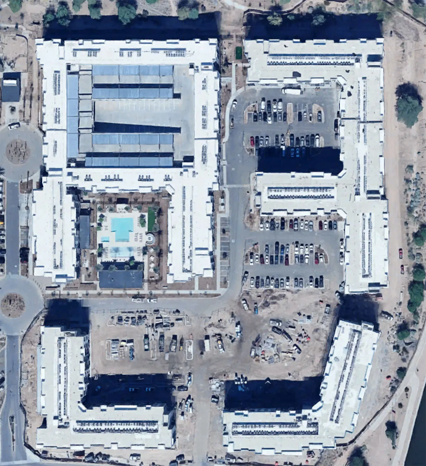
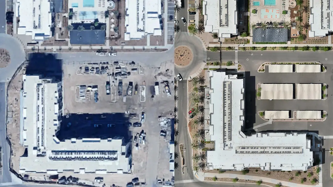
When you need a top-down view of a job site, a property, or a large commercial roof, your first instinct might be to pull up a satellite image. Tools like Google Earth and Bing Maps are fast, free, and easy to access — so why not just use those?
The problem is, satellite images aren't built for precision, especially in construction, inspections, or planning work where accuracy and detail matter. That’s where drone mapping comes in.
Below, we’ll break down how drone imagery compares to satellite imagery — and when it makes sense to hire a drone operator to get the job done right.
📸 1. Image Clarity and Resolution
Satellite imagery often looks decent at first glance, but it falls apart when you zoom in. Most free sources offer 30–50 cm/pixel resolution at best, and even premium satellite services rarely beat 10 cm/pixel.
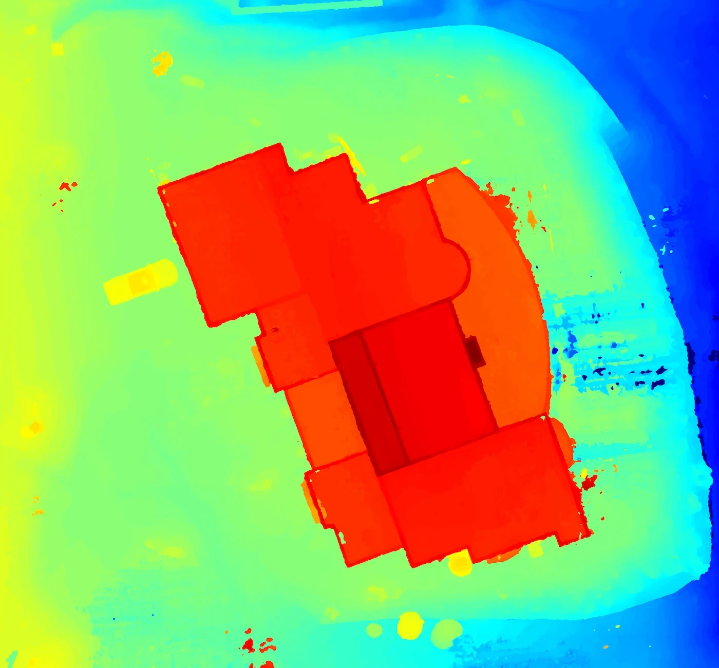
Drone mapping, on the other hand, can produce images at sub-1 cm/pixel resolution — that’s 30–50 times more detailed.
For roof inspections, construction updates, or precise measurements, that detail isn't optional — it's the difference between seeing a roof and seeing a crack in the roof.
Example:
A commercial roof may look fine from a satellite, but a drone image reveals pooling water, flashing damage, or missing HVAC parts.
🕐 2. Timeliness of Data
Satellite images are often weeks to months old, and there’s no guarantee when the next update will happen.
Drones capture imagery on-demand, which means:
You're always working with current site conditions
You can track progress at regular intervals
You can re-capture after storms, changes, or milestones
Want to monitor a construction site every week? Satellite images simply can’t keep up.
🎯 3. Accuracy and Measurability
Most satellite imagery isn’t georeferenced to the level needed for accurate distance, area, or volume measurements.
Professional drone mapping uses:
Ground Sampling Distance (GSD) for image precision
RTK/PPK for centimeter-level GPS accuracy
Photogrammetry software to create measurable 2D orthomosaics and 3D models
This level of accuracy is what allows builders, roofers, engineers, and surveyors to use drone maps for real calculations — not just visuals.
🧰 4. Flexibility and Control
With a satellite, you get whatever was captured at the time — the angle, lighting, resolution, and date are all out of your control.
Drones offer:
Custom angles: nadir (top-down), oblique (angled), or 360 views
Thermal imaging for HVAC and energy inspections
3D modeling of sites, structures, or terrain
Area-specific flight plans, tailored to the exact size and shape of your project
You’re not stuck waiting on a blurry overhead image from 6 months ago — you get exactly what you need, when you need it.
🛡️ 5. Privacy and Compliance
Using drones means:
You can stay within legal airspace
Work with a licensed Part 107 operator who knows the rules
Get data that’s ethically and securely collected
No guessing where the satellite came from, or what rights you have to use the image.
✅ Bottom Line
Satellite imagery has its place — it’s great for context, general planning, or seeing how an area has changed over time.
But when you need:
Up-to-date imagery
High-resolution detail
Measurable data
Or custom views of your project
Drone mapping wins, every time.
Want better than satellite?
Contact us to see what a drone map can really do — and how it’ll help your project move faster, safer, and smarter.
More from the blog
Drone Mapping vs. Satellite Imagery: What’s the Difference?
In-depth perspectives on drone technology, industry shifts, and the future of aerial work—shared from the pilot’s point of view.
Apr 25, 2025
Drone Mapping vs. Satellite Imagery: What’s the Difference — and Why It Matters
When you need a top-down view of a job site, a property, or a large commercial roof, your first instinct might be to pull up a satellite image. Tools like Google Earth and Bing Maps are fast, free, and easy to access — so why not just use those?
The problem is, satellite images aren't built for precision, especially in construction, inspections, or planning work where accuracy and detail matter. That’s where drone mapping comes in.
Below, we’ll break down how drone imagery compares to satellite imagery — and when it makes sense to hire a drone operator to get the job done right.
📸 1. Image Clarity and Resolution
Satellite imagery often looks decent at first glance, but it falls apart when you zoom in. Most free sources offer 30–50 cm/pixel resolution at best, and even premium satellite services rarely beat 10 cm/pixel.
Drone mapping, on the other hand, can produce images at sub-1 cm/pixel resolution — that’s 30–50 times more detailed.
For roof inspections, construction updates, or precise measurements, that detail isn't optional — it's the difference between seeing a roof and seeing a crack in the roof.
Example:
A commercial roof may look fine from a satellite, but a drone image reveals pooling water, flashing damage, or missing HVAC parts.
🕐 2. Timeliness of Data
Satellite images are often weeks to months old, and there’s no guarantee when the next update will happen.
Drones capture imagery on-demand, which means:
You're always working with current site conditions
You can track progress at regular intervals
You can re-capture after storms, changes, or milestones
Want to monitor a construction site every week? Satellite images simply can’t keep up.
🎯 3. Accuracy and Measurability
Most satellite imagery isn’t georeferenced to the level needed for accurate distance, area, or volume measurements.
Professional drone mapping uses:
Ground Sampling Distance (GSD) for image precision
RTK/PPK for centimeter-level GPS accuracy
Photogrammetry software to create measurable 2D orthomosaics and 3D models
This level of accuracy is what allows builders, roofers, engineers, and surveyors to use drone maps for real calculations — not just visuals.
🧰 4. Flexibility and Control
With a satellite, you get whatever was captured at the time — the angle, lighting, resolution, and date are all out of your control.
Drones offer:
Custom angles: nadir (top-down), oblique (angled), or 360 views
Thermal imaging for HVAC and energy inspections
3D modeling of sites, structures, or terrain
Area-specific flight plans, tailored to the exact size and shape of your project
You’re not stuck waiting on a blurry overhead image from 6 months ago — you get exactly what you need, when you need it.
🛡️ 5. Privacy and Compliance
Using drones means:
You can stay within legal airspace
Work with a licensed Part 107 operator who knows the rules
Get data that’s ethically and securely collected
No guessing where the satellite came from, or what rights you have to use the image.
✅ Bottom Line
Satellite imagery has its place — it’s great for context, general planning, or seeing how an area has changed over time.
But when you need:
Up-to-date imagery
High-resolution detail
Measurable data
Or custom views of your project
Drone mapping wins, every time.
Want better than satellite?
Contact us to see what a drone map can really do — and how it’ll help your project move faster, safer, and smarter.
More from the blog
11 Apr 2025
The Drone Industry Is Taking Off — And It’s Just Getting Started
Read more
11 Apr 2025
The Drone Industry Is Taking Off — And It’s Just Getting Started
Read more
11 Jun 2025
What Does a Drone Inspection Actually Look Like?
Read more
11 Jun 2025
What Does a Drone Inspection Actually Look Like?
Read more
2 May 2025
Why You Should Hire a Professional Drone Operator
Read more
2 May 2025
Why You Should Hire a Professional Drone Operator
Read more
Precision Drone Data. Delivered Fast.
Accurate aerials and insights when you need them.