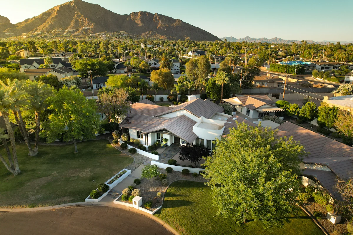
Phoenix, AZ
Phoenix, AZ
Phoenix, AZ

Trusted by 50+ clients
Arizona’s #1 Trusted Drone Services
Serving Arizona & Beyond with Precision Aerial Data — for smarter decisions, faster workflows, and clearer insights.
Trusted by 50+ clients
Trusted by 50+ clients
Arizona’s #1 Trusted Drone Services
Serving Arizona & Beyond with Precision Aerial Data — for smarter decisions, faster workflows, and clearer insights.
Trusted by 50+ clients
Trusted by 50+ clients
Arizona’s #1 Trusted Drone Services
Serving Arizona & Beyond with Precision Aerial Data — for smarter decisions, faster workflows, and clearer insights.
Trusted by 50+ clients
About us
About us
About us
We Are Aerial Data Specialists.
Get fast, detailed aerial visuals that save time, reduce guesswork, and drive better project outcomes.
FAA Part 107 Certified & Fully Insured. Trusted for compliant, professional aerial data.
0+
0+
Years Experience
0+
0+
Years Experience
0+
0+
Years Experience
0+
0+
Projects Completed
0+
0+
Projects Completed
0+
0+
Projects Completed
0%
0%
Client Satisfaction
0%
0%
Client Satisfaction
0%
0%
Client Satisfaction
Services
Services
Services
What we do
Find out which one of our services fit the needs of your project
Drone Mapping
We produce ultra-high-resolution orthomosaics, elevation models, and 3D site maps to help you plan, measure, and manage your site with confidence — ideal for builders, developers, and commercial landowners.
Used by
Jobsite planning, terrain analysis, land development
Drone Mapping
We produce ultra-high-resolution orthomosaics, elevation models, and 3D site maps to help you plan, measure, and manage your site with confidence — ideal for builders, developers, and commercial landowners.
Used by
Jobsite planning, terrain analysis, land development
Drone Mapping
We produce ultra-high-resolution orthomosaics, elevation models, and 3D site maps to help you plan, measure, and manage your site with confidence — ideal for builders, developers, and commercial landowners.
Used by
Jobsite planning, terrain analysis, land development
Construction Monitoring
We provide scheduled aerial updates to document your build, catch issues early, and give stakeholders real-time insight. Great for client reporting, insurance documentation, or progress visualization.
Used by
Builders, GCs, remodelers, custom home projects
Construction Monitoring
We provide scheduled aerial updates to document your build, catch issues early, and give stakeholders real-time insight. Great for client reporting, insurance documentation, or progress visualization.
Used by
Builders, GCs, remodelers, custom home projects
Construction Monitoring
We provide scheduled aerial updates to document your build, catch issues early, and give stakeholders real-time insight. Great for client reporting, insurance documentation, or progress visualization.
Used by
Builders, GCs, remodelers, custom home projects
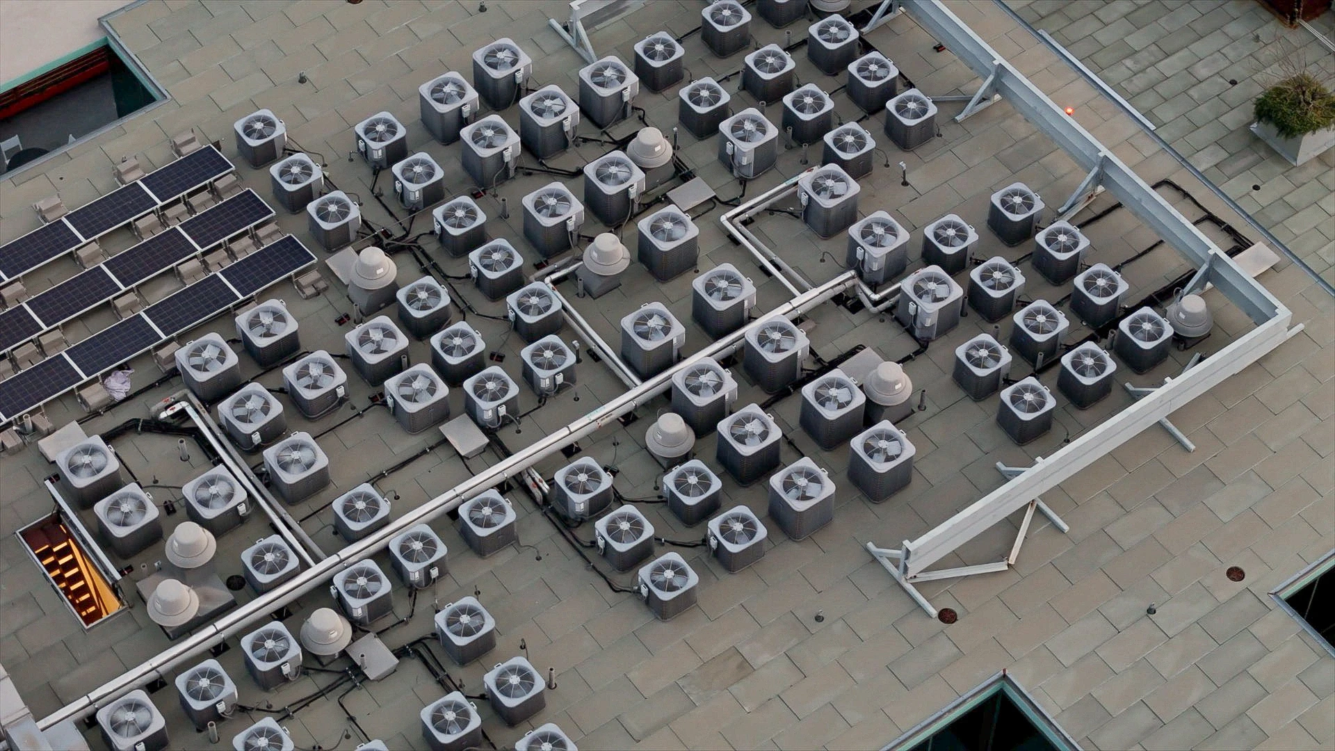
Roof Inspections
No ladders. No liability. Just data. Quick, detailed aerial inspections that capture roof condition, damage, and measurements — with clear, actionable visuals and fast turnaround. Ideal for roofing contractors, insurance adjusters, and solar installers.
Used by
Commercial & residential roofs
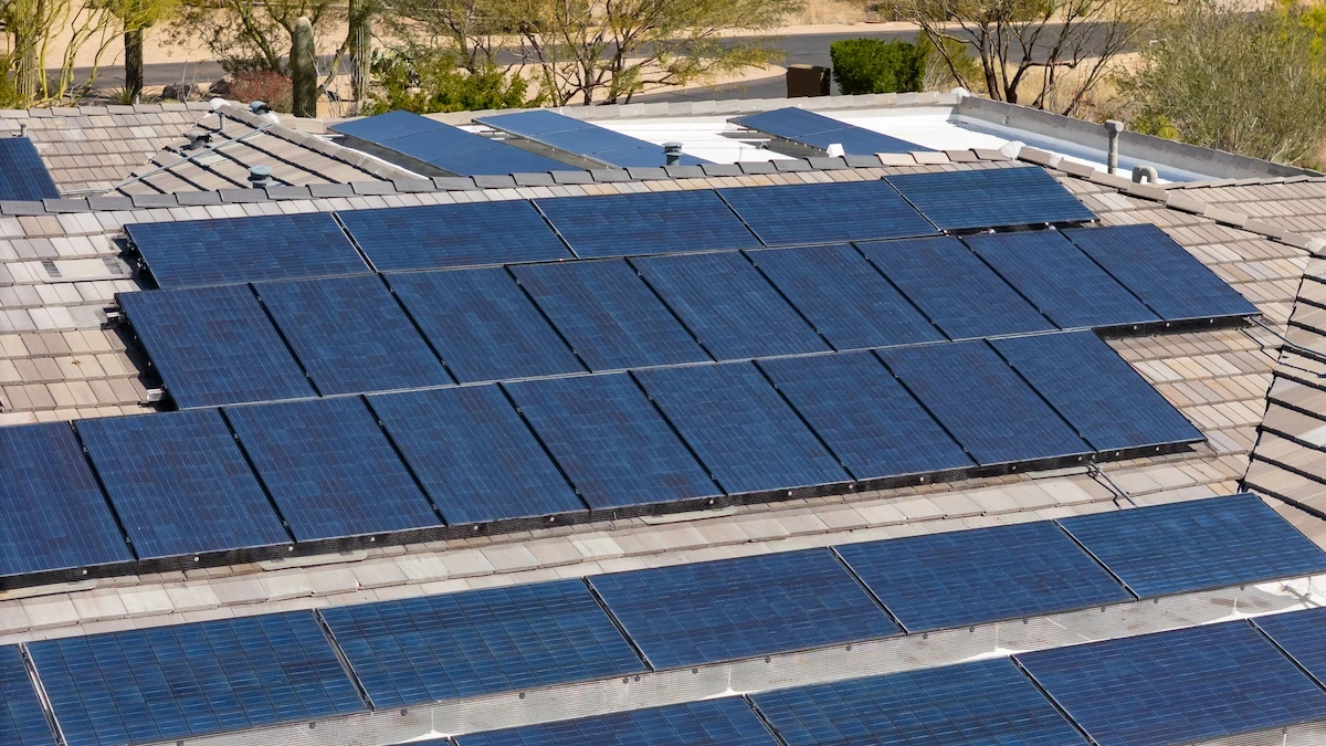
Solar Panel Inspections
Using high-resolution visuals and thermal imaging, we help solar companies identify panel damage, inefficiencies, and dirt buildup — without setting foot on the roof.
Used by
Solar O&M teams, homeowners, installers
Solar Panel Inspections
Using high-resolution visuals and thermal imaging, we help solar companies identify panel damage, inefficiencies, and dirt buildup — without setting foot on the roof.
Used by
Solar O&M teams, homeowners, installers
Solar Panel Inspections
Using high-resolution visuals and thermal imaging, we help solar companies identify panel damage, inefficiencies, and dirt buildup — without setting foot on the roof.
Used by
Solar O&M teams, homeowners, installers
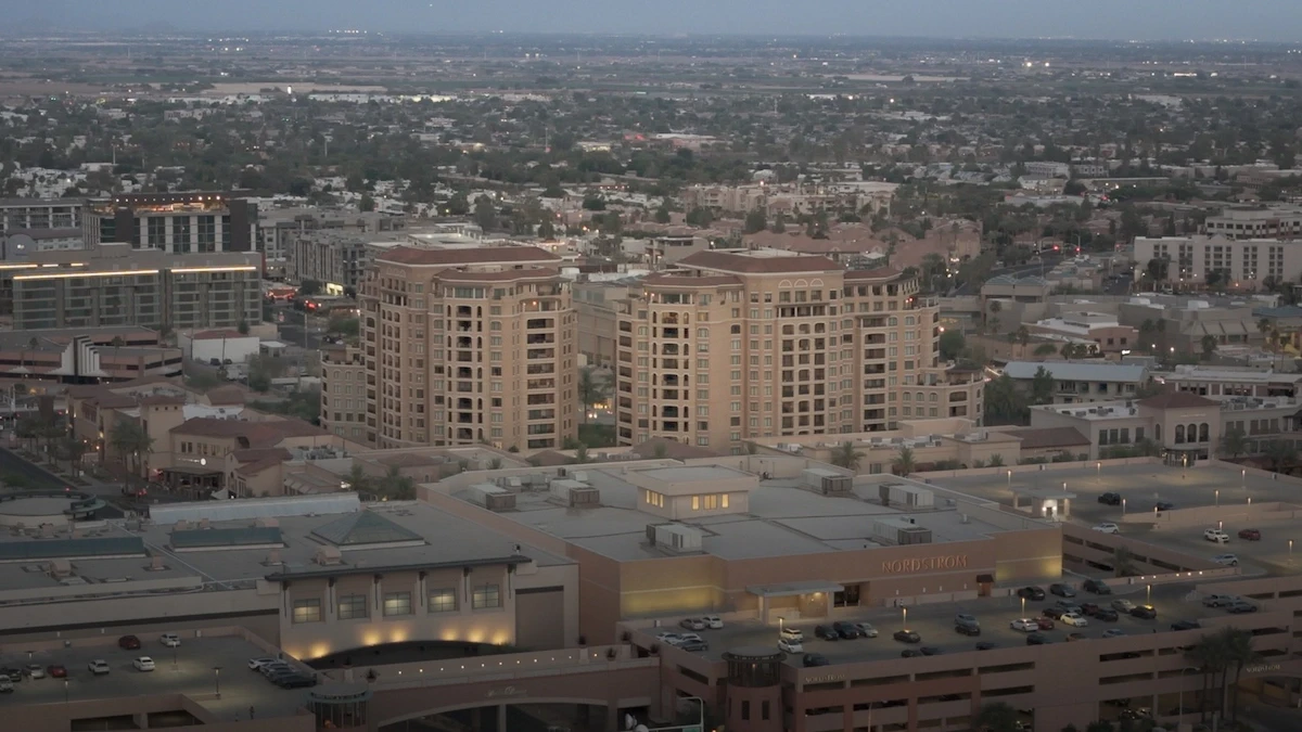
Aerial Photo & Videography
Capture cinematic, stabilized 4K aerial footage or stunning stills — perfect for real estate, social media, or client updates. Shot with precision, edited for clarity.
Used by
Realtors, builders, commercial marketing
Aerial Photo & Videography
Capture cinematic, stabilized 4K aerial footage or stunning stills — perfect for real estate, social media, or client updates. Shot with precision, edited for clarity.
Used by
Realtors, builders, commercial marketing
Aerial Photo & Videography
Capture cinematic, stabilized 4K aerial footage or stunning stills — perfect for real estate, social media, or client updates. Shot with precision, edited for clarity.
Used by
Realtors, builders, commercial marketing
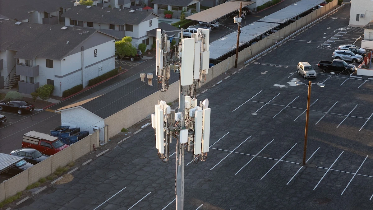
More Services
From powerline and telecom inspections to thermal imaging and agriculture mapping — we tailor each mission to your project needs, with precision, clarity, and fast turnaround.
Used by
Utility providers, engineers, energy companies, and land managers
More Services
From powerline and telecom inspections to thermal imaging and agriculture mapping — we tailor each mission to your project needs, with precision, clarity, and fast turnaround.
Used by
Utility providers, engineers, energy companies, and land managers
More Services
From powerline and telecom inspections to thermal imaging and agriculture mapping — we tailor each mission to your project needs, with precision, clarity, and fast turnaround.
Used by
Utility providers, engineers, energy companies, and land managers
Our work
Our work
Our work
See the Results of Our Work
See how our drone work helps clients save time, reduce risk, and make faster, more confident decisions.
See how our drone work helps clients save time, reduce risk, and make faster, more confident decisions.
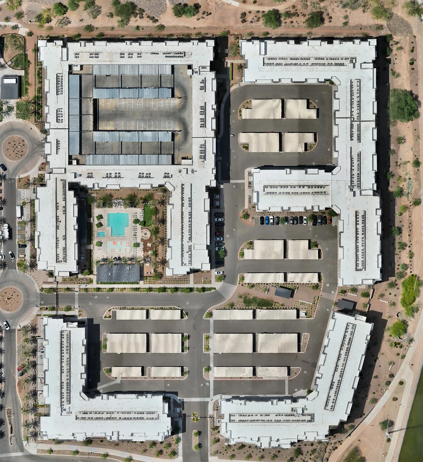
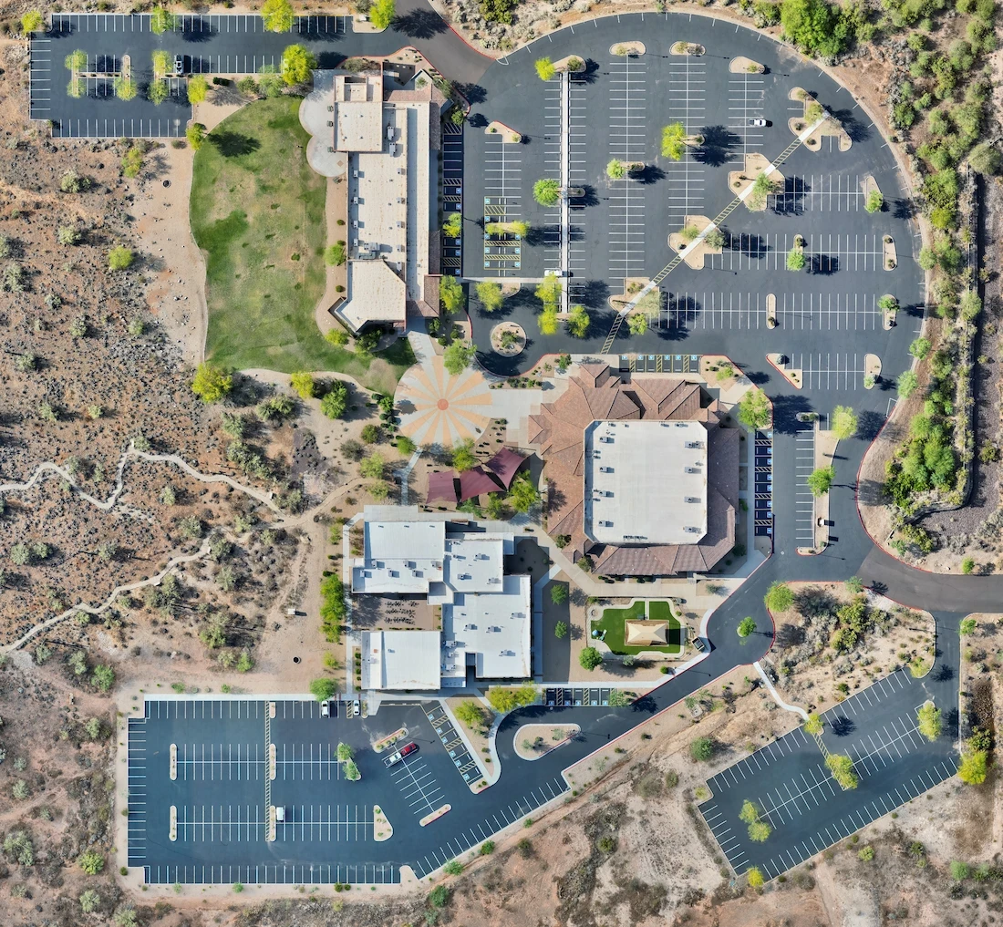
From Blurry to Accurate
A newly finished development in Scottsdale still appeared unfinished on public satellite maps. We created a detailed orthomosaic of the site, providing stakeholders with a current, high-resolution overview. The drone map offered real-time visuals of completed structures, improving documentation, planning, and showcasing the build to future tenants or buyers.
Drone Mapping
This was the only up-to-date view of the site we had. It helped us align our planning with what was actually finished and saved us from using outdated satellite images.
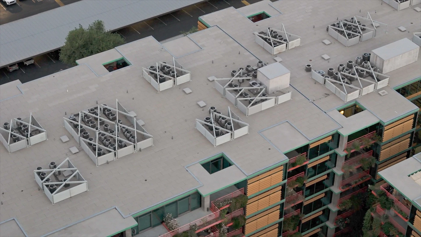
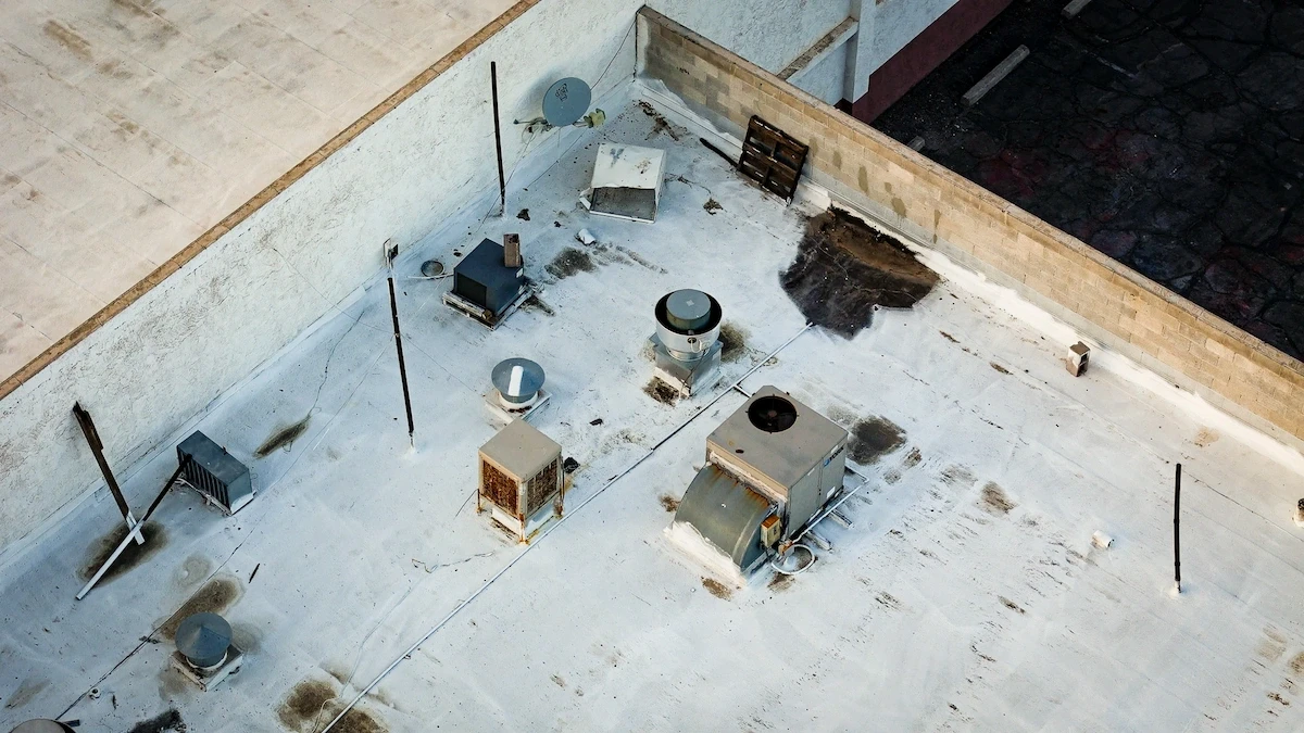
No Ladders, Just Insight
Following a heavy monsoon, we inspected the roof of a multi-story commercial building in Scottsdale. Our aerial photos highlighted potential pooling areas, HVAC unit issues, and visible membrane wear—without sending anyone up a ladder. Same-day visuals and a quick turnaround helped the client prioritize repairs quickly and safely.
Roof Inspection
Arizona storms hit hard. Having clear, immediate aerial images gave us everything we needed to act fast—without climbing on the roof.
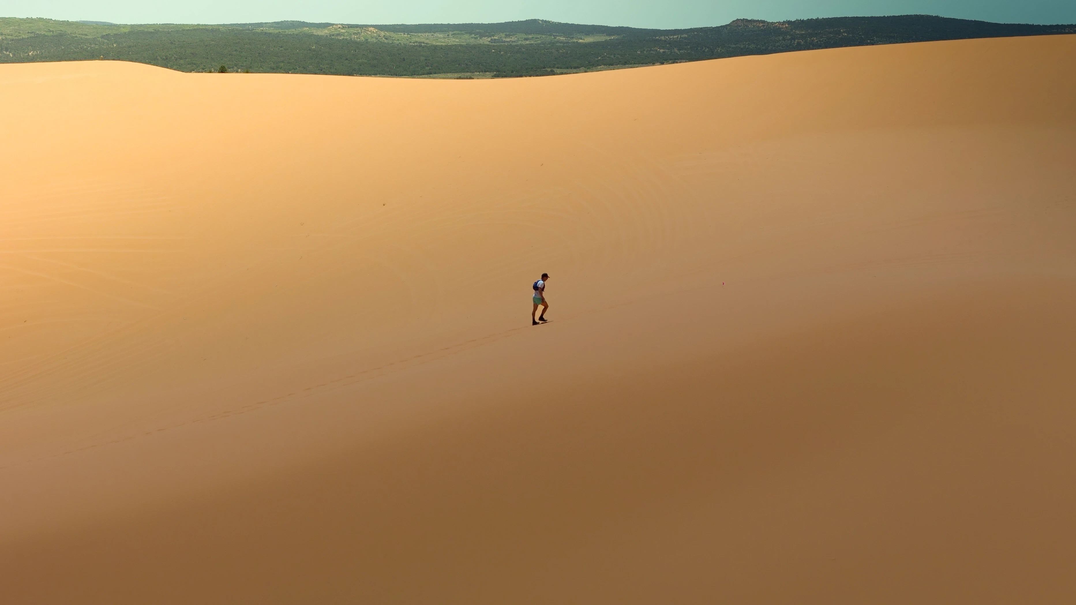
Telling the Story from Above
We covered an ultramarathon across the Arizona & Utah desert, capturing dynamic aerial visuals of the runners in vast dunes and rugged terrain. Our drone photo/video content helped organizers promote the event with cinematic footage that highlighted the scale, intensity, and unique landscape of the race.
Aerial Photo & Video
The drone footage made our event look epic. It brought the emotion, the effort, and the terrain to life—we’ve already seen a bump in interest for next year!
Testimonials
Testimonials
Testimonials
Hear from our clients
Hear from the people we’ve worked with — and how aerial data helped move their projects forward.
The aerial map showed things we never would’ve caught on satellite — it completely changed how we planned the project.

Alex Ramirez, Site Planner
Super clear. Super fast. Our client loved seeing real progress from the air instead of just reading reports.

Mark Elliot, Construction Manager
It’s the best decision we made this quarter — the drone data helped avoid a major miscommunication with our team.

Natalie B., GC Project Lead
We had a quote in hand the same day. No climbing, no back-and-forth. The drone photos made it easy.
Tina Nguyen, Roofing Contractor
We needed thermal visuals of a rooftop array. The drone inspection saved us hours of manual work.

Eric Stone, Solar Tech Lead
Adding drone photos to our listing helped us stand out. It gave buyers a way better sense of the property.

Jenna Ruiz, Real Estate Agent
They showed up, mapped the land in one flight, and had it processed within 24 hours. Couldn’t have been easier.

Chris M., Developer
Their drone work helped us document everything for insurance after the storm — clean, fast, and accurate.
Jordan Fields, Facility Manager
The aerial map showed things we never would’ve caught on satellite — it completely changed how we planned the project.
Alex Ramirez, Site Planner
Super clear. Super fast. Our client loved seeing real progress from the air instead of just reading reports.
Mark Elliot, Construction Manager
It’s the best decision we made this quarter — the drone data helped avoid a major miscommunication with our team.
Natalie B., GC Project Lead
We had a quote in hand the same day. No climbing, no back-and-forth. The drone photos made it easy.
Tina Nguyen, Roofing Contractor
We needed thermal visuals of a rooftop array. The drone inspection saved us hours of manual work.
Eric Stone, Solar Tech Lead
Adding drone photos to our listing helped us stand out. It gave buyers a way better sense of the property.
Jenna Ruiz, Real Estate Agent
They showed up, mapped the land in one flight, and had it processed within 24 hours. Couldn’t have been easier.
Chris M., Developer
Their drone work helped us document everything for insurance after the storm — clean, fast, and accurate.
Jordan Fields, Facility Manager

Featured
16 Mar 2025
Desert Luxury, Elevated Views Sell Faster
High-end real estate deserves a high-end perspective — see how drone visuals added impact.
Read more
Featured
16 Mar 2025
Desert Luxury, Elevated Views Sell Faster
High-end real estate deserves a high-end perspective — see how drone visuals added impact.
Read more
Featured
16 Mar 2025
Desert Luxury, Elevated Views Sell Faster
High-end real estate deserves a high-end perspective — see how drone visuals added impact.
Read more
Drone Mapping
23 Mar 2025
Precision Mapping for Property Planning
Read more
Drone Mapping
23 Mar 2025
Precision Mapping for Property Planning
Read more
Drone Mapping
23 Mar 2025
Precision Mapping for Property Planning
Read more
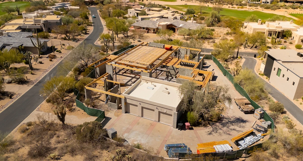
Construction Monitoring
27 Feb 2025
Troon North: Aerial Progress Tracking
Read more
Construction Monitoring
27 Feb 2025
Troon North: Aerial Progress Tracking
Read more
Construction Monitoring
27 Feb 2025
Troon North: Aerial Progress Tracking
Read more
Roof Inspections
18 Jan 2025
Smart Roof Inspections for Complex Buildings
Read more
Roof Inspections
18 Jan 2025
Smart Roof Inspections for Complex Buildings
Read more
Roof Inspections
18 Jan 2025
Smart Roof Inspections for Complex Buildings
Read more
FAQs
FAQs
FAQs
Answering your questions
Got more questions? Reach out to us using the button below
How much do drone services cost?
Pricing varies by service, site size, and deliverables. We offer free consultations and provide tailored quotes after understanding your goals.
Do I need permits or permission to hire a drone operator?
In most cases, no — we handle FAA compliance and airspace checks. If your site is in restricted airspace, we’ll walk you through next steps.
How long does it take to get results?
Many deliverables (like photos, maps, or inspections) are turned around in 24–48 hours. Large mapping or modeling projects may take slightly longer.
Can you work on active construction or commercial sites?
Yes — we’re trained and insured to operate around active sites, buildings, rooftops, and infrastructure. Safety is our top priority.
What kind of reporting or files will I get?
Depending on the service, you’ll receive high-resolution images, PDFs, 3D models, orthomosaics, or annotated reports — ready for sharing or quoting.
What areas do you cover?
We’re based in Phoenix and primarily serve Arizona — including Cave Creek, Scottsdale, Mesa, and nearby areas. Need work outside this? Just ask.
Can you do thermal, solar, or utility inspections?
Yes — we offer thermal imaging, solar panel assessments, and utility infrastructure inspections (including telecom and powerlines).
What’s the best way to get started?
Just reach out through our contact form. We’ll ask a few questions about your site, needs, and timeline — and guide you from there.
Precision Drone Data. Delivered Fast.
Accurate aerials and insights when you need them.