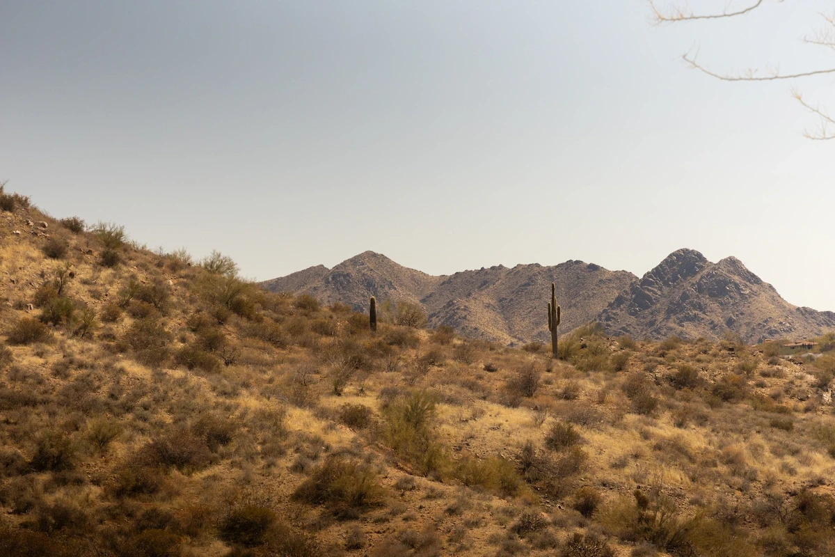
Phoenix, AZ
Phoenix, AZ
Phoenix, AZ
What Does a Drone Inspection Actually Look Like?
In-depth perspectives on drone technology, industry shifts, and the future of aerial work—shared from the pilot’s point of view.
Jun 11, 2025
What Does a Drone Inspection Actually Look Like?
Whether you're a property manager, builder, or business owner, you've probably heard about drone inspections — but what do they actually involve? Are they just flashy overhead shots, or can they deliver real, usable insight?
Let’s walk through what a professional drone inspection actually looks like — and why more industries are turning to drones over ladders and clipboards.
🛠️ What Happens During a Drone Inspection?
At its core, a drone inspection replaces risky, time-consuming manual checks with high-resolution, aerial data collection. Here's what typically happens:
1. Pre-Flight Planning
The operator reviews the inspection site, sets altitude, and defines a flight path.
RTK (real-time kinematic positioning) may be used for centimeter-level precision.
The drone is checked for weather conditions, battery life, and airspace clearance (Part 107 compliance).
2. Aerial Data Capture
The drone flies either:
Manually, for targeted visual inspections, or
Autonomously, using pre-programmed flight paths for mapping and modeling
Drones capture:
High-res photos
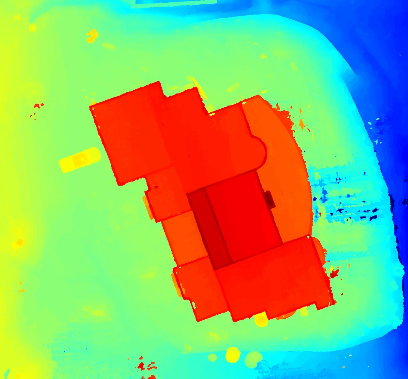
Thermal imagery (for heat loss, moisture, or electrical hotspots)
Video footage
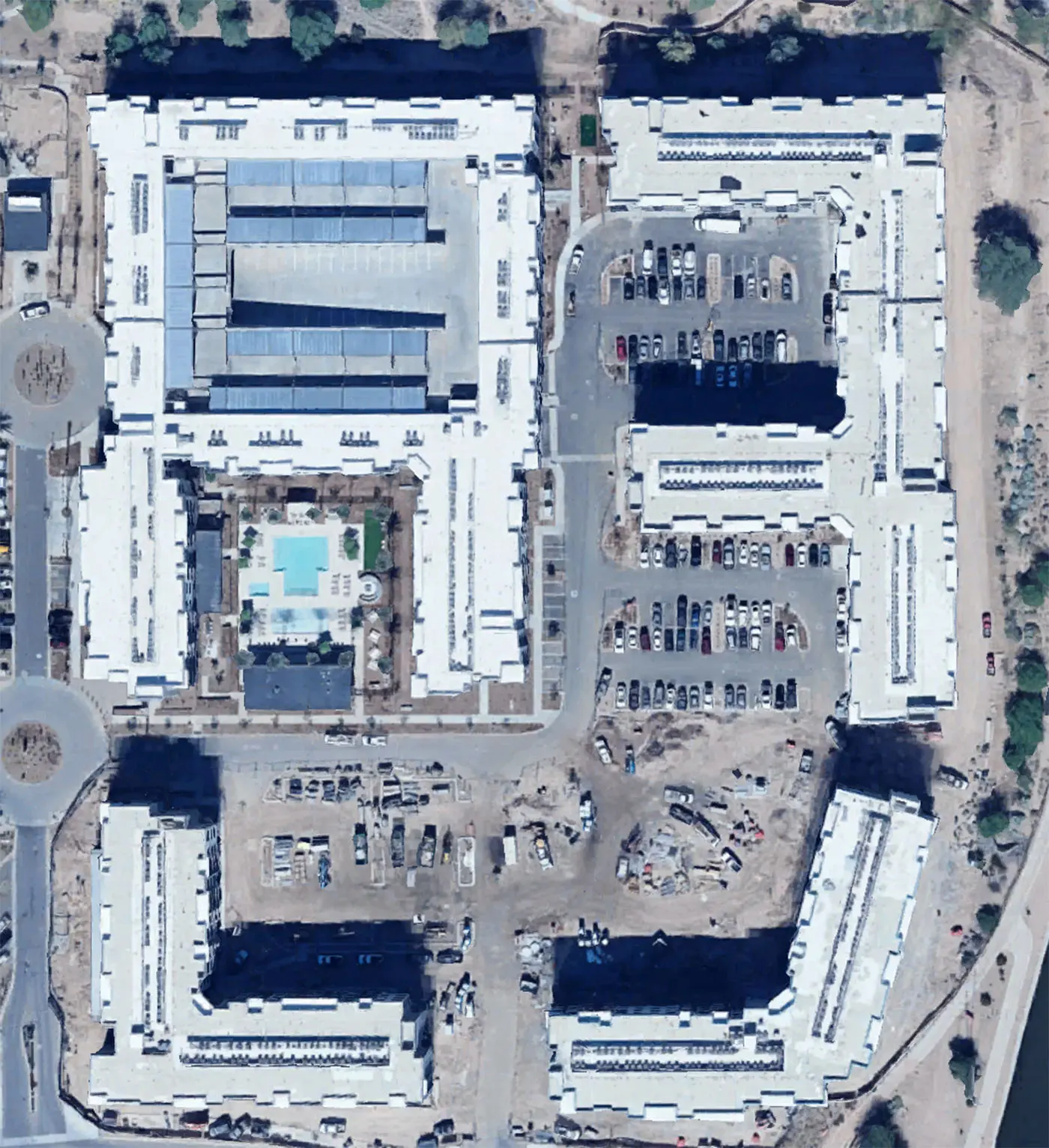
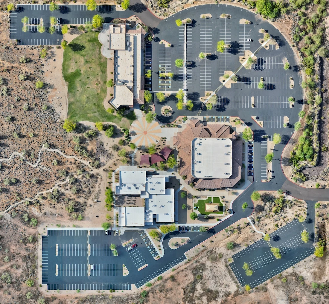
3D models (using photogrammetry)
Orthomosaic maps (stitched aerial photos for large surface analysis)
3. Post-Processing & Data Analysis
After the flight, the data is processed to:
Stitch orthomosaics and 3D models
Extract measurements (e.g. area, pitch, volume)
Flag anomalies or damage using visual and thermal cues
The result: a clean, visual report that's far more detailed — and safer — than someone walking a roof or climbing a tower.
🏗️ What Can Be Inspected with Drones?
Drone inspections are now used across industries:
🔹 Roofing
Spot hail or storm damage
Measure square footage or slope
Detect leaks using thermal cameras
🔹 Construction
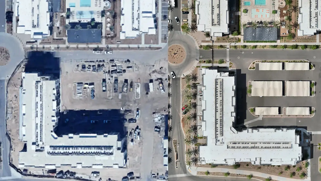
Track build progress over time
Compare as-built vs. as-designed
Monitor safety zones and compliance
🔹 Commercial Real Estate & Facilities
Document condition for insurance or valuation
Identify HVAC or solar panel issues
Create 3D models of complex structures
🔹 Infrastructure (Telco, Energy, Utilities)
Inspect towers, power lines, substations, flare stacks
Detect heat loss, corrosion, or electrical faults
Eliminate need for rope access or lifts
🔍 What You Get After an Inspection
Depending on the scope, deliverables can include:
📸 High-resolution visual photos (4K+)
🌡️ Thermal imagery (with temperature scale overlays)
🗺️ Orthomosaic map (geo-referenced top-down image accurate to inches/cm)
🧱 3D model (viewable and measurable in-browser or exported)
📊 Inspection report (summarizing key findings and areas of concern)
These files can be shared, viewed online, or integrated into tools like AutoCAD, ArcGIS, or maintenance systems.
🧠 Why It’s Better Than Traditional Methods
Traditional | Drone-Based |
|---|---|
Manual climbing | No-risk aerial capture |
Human error & missed spots | Full coverage with high-res zoom |
Long, expensive site visits | Quick, autonomous flights |
Subjective assessment | Visual + thermal data you can measure |
💬 Final Thoughts
A drone inspection isn’t just about getting “cool shots” — it’s about smarter, safer, and more cost-effective insight. Whether you're inspecting a 10,000 sq ft commercial roof, monitoring jobsite progress, or checking for damage post-storm, drones deliver real-world value that saves time and money.
Curious what a drone inspection would show on your property or site?
Schedule a free consultation or explore our services — we’ll help you see what’s possible from above.
More from the blog
What Does a Drone Inspection Actually Look Like?
In-depth perspectives on drone technology, industry shifts, and the future of aerial work—shared from the pilot’s point of view.
Jun 11, 2025
What Does a Drone Inspection Actually Look Like?
Whether you're a property manager, builder, or business owner, you've probably heard about drone inspections — but what do they actually involve? Are they just flashy overhead shots, or can they deliver real, usable insight?
Let’s walk through what a professional drone inspection actually looks like — and why more industries are turning to drones over ladders and clipboards.
🛠️ What Happens During a Drone Inspection?
At its core, a drone inspection replaces risky, time-consuming manual checks with high-resolution, aerial data collection. Here's what typically happens:
1. Pre-Flight Planning
The operator reviews the inspection site, sets altitude, and defines a flight path.
RTK (real-time kinematic positioning) may be used for centimeter-level precision.
The drone is checked for weather conditions, battery life, and airspace clearance (Part 107 compliance).
2. Aerial Data Capture
The drone flies either:
Manually, for targeted visual inspections, or
Autonomously, using pre-programmed flight paths for mapping and modeling
Drones capture:
High-res photos
Thermal imagery (for heat loss, moisture, or electrical hotspots)
Video footage
3D models (using photogrammetry)
Orthomosaic maps (stitched aerial photos for large surface analysis)
3. Post-Processing & Data Analysis
After the flight, the data is processed to:
Stitch orthomosaics and 3D models
Extract measurements (e.g. area, pitch, volume)
Flag anomalies or damage using visual and thermal cues
The result: a clean, visual report that's far more detailed — and safer — than someone walking a roof or climbing a tower.
🏗️ What Can Be Inspected with Drones?
Drone inspections are now used across industries:
🔹 Roofing
Spot hail or storm damage
Measure square footage or slope
Detect leaks using thermal cameras
🔹 Construction
Track build progress over time
Compare as-built vs. as-designed
Monitor safety zones and compliance
🔹 Commercial Real Estate & Facilities
Document condition for insurance or valuation
Identify HVAC or solar panel issues
Create 3D models of complex structures
🔹 Infrastructure (Telco, Energy, Utilities)
Inspect towers, power lines, substations, flare stacks
Detect heat loss, corrosion, or electrical faults
Eliminate need for rope access or lifts
🔍 What You Get After an Inspection
Depending on the scope, deliverables can include:
📸 High-resolution visual photos (4K+)
🌡️ Thermal imagery (with temperature scale overlays)
🗺️ Orthomosaic map (geo-referenced top-down image accurate to inches/cm)
🧱 3D model (viewable and measurable in-browser or exported)
📊 Inspection report (summarizing key findings and areas of concern)
These files can be shared, viewed online, or integrated into tools like AutoCAD, ArcGIS, or maintenance systems.
🧠 Why It’s Better Than Traditional Methods
Traditional | Drone-Based |
|---|---|
Manual climbing | No-risk aerial capture |
Human error & missed spots | Full coverage with high-res zoom |
Long, expensive site visits | Quick, autonomous flights |
Subjective assessment | Visual + thermal data you can measure |
💬 Final Thoughts
A drone inspection isn’t just about getting “cool shots” — it’s about smarter, safer, and more cost-effective insight. Whether you're inspecting a 10,000 sq ft commercial roof, monitoring jobsite progress, or checking for damage post-storm, drones deliver real-world value that saves time and money.
Curious what a drone inspection would show on your property or site?
Schedule a free consultation or explore our services — we’ll help you see what’s possible from above.
More from the blog
11 Apr 2025
The Drone Industry Is Taking Off — And It’s Just Getting Started
Read more
11 Apr 2025
The Drone Industry Is Taking Off — And It’s Just Getting Started
Read more
2 May 2025
Why You Should Hire a Professional Drone Operator
Read more
2 May 2025
Why You Should Hire a Professional Drone Operator
Read more
25 Apr 2025
Drone Mapping vs. Satellite Imagery: What’s the Difference?
Read more
25 Apr 2025
Drone Mapping vs. Satellite Imagery: What’s the Difference?
Read more
Precision Drone Data. Delivered Fast.
Accurate aerials and insights when you need them.