
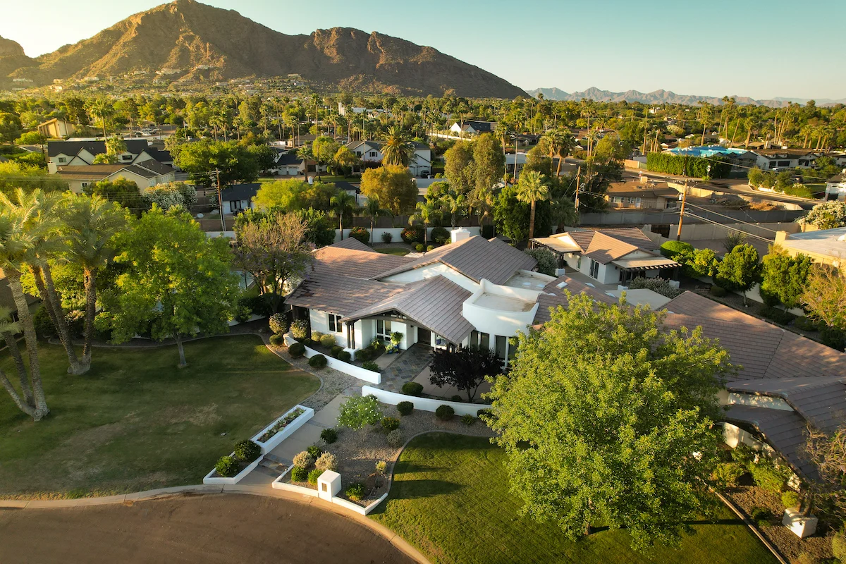
Phoenix, AZ
Phoenix, AZ
Phoenix, AZ
How Drone Mapping Saves Time and Money for Arizona Contractors
In-depth perspectives on drone technology, industry shifts, and the future of aerial work—shared from the pilot’s point of view.
Feb 22, 2025
Why Mapping Matters in Arizona Construction
Arizona construction projects face tight timelines, labor shortages, and heat that limits working hours. Getting accurate, up-to-date site data fast is critical — and that’s exactly where drone mapping delivers.
What Is Drone Mapping?
Drone mapping uses:
Nadir images (straight down)
RTK positioning for survey-level accuracy
Flight planning software like DJI Terra
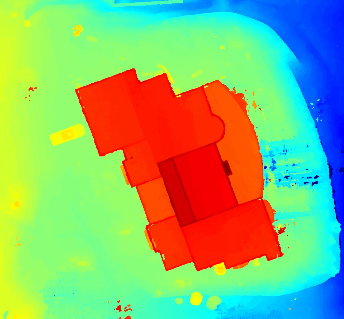
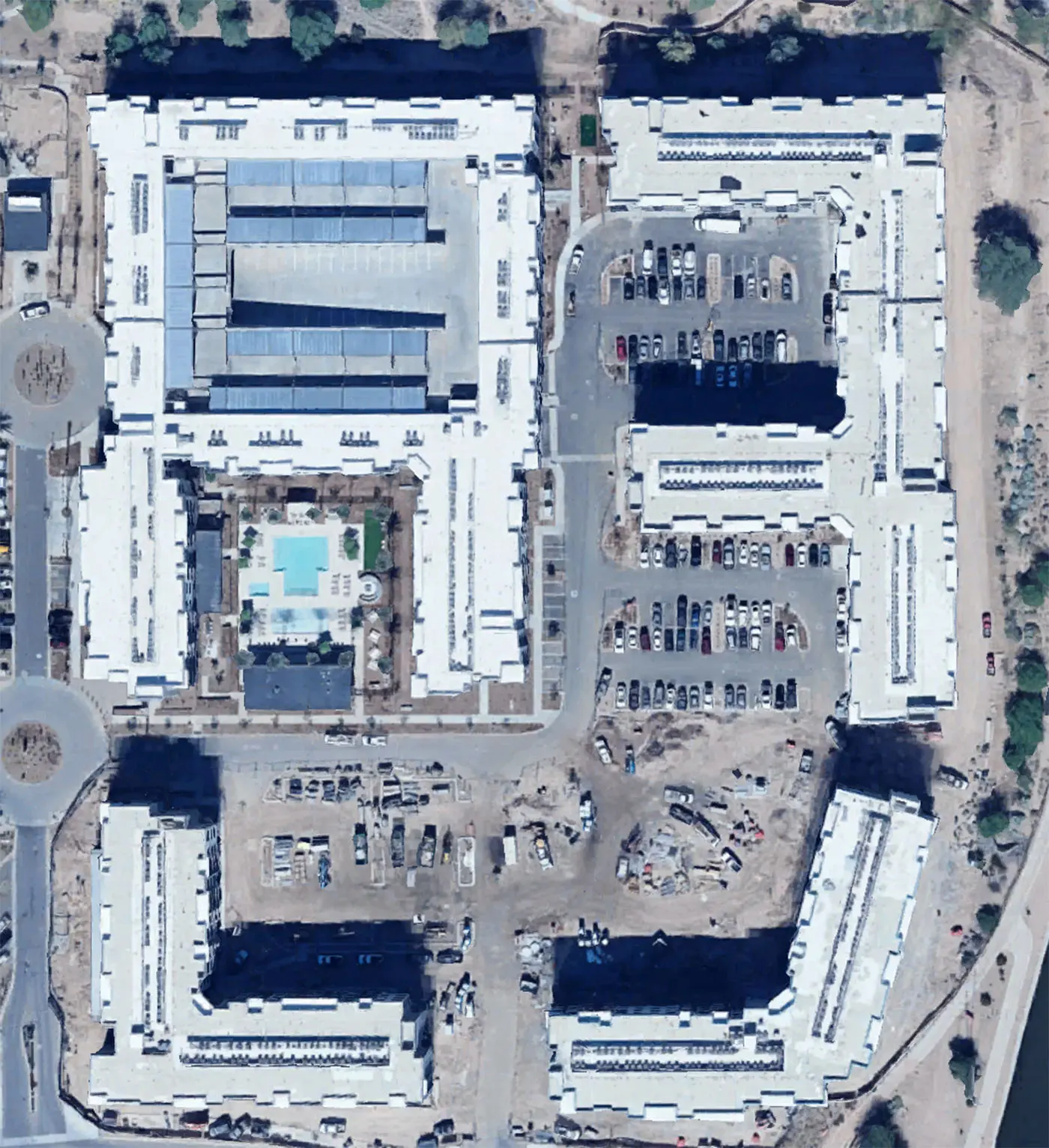
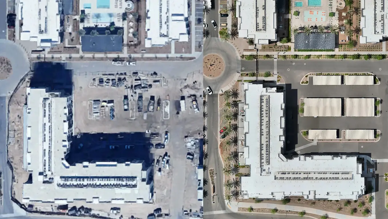
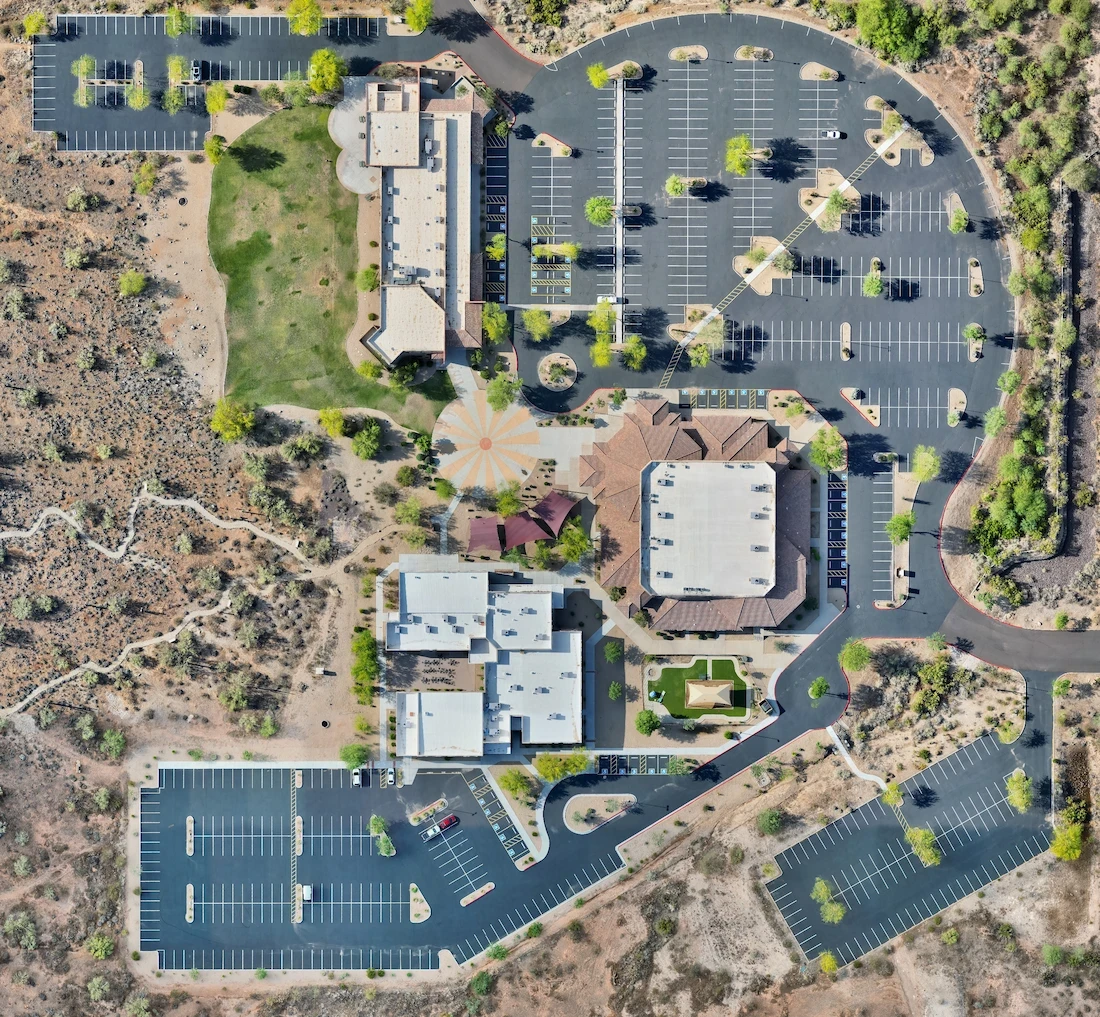
This data is stitched into high-resolution orthomosaic maps or 3D models accurate to within centimeters.
How It Saves Time
Traditional surveying can take days. Drone mapping captures:
50–100 acres in under an hour
Automatically processed maps within 24–48 hours
Repeatable missions for weekly updates
Site supervisors, architects, and subcontractors can all reference the same map — from the office or on-site.
How It Saves Money
🚧 Fewer reworks thanks to accurate planning
🧑🔧 Reduced labor time for measuring, marking, or site walks
🏗 Catch grading and drainage issues before they become expensive
📦 Inventory & material volume checks to avoid overordering
In a market like Phoenix where labor is limited and deadlines are tight, this adds up fast.
Real Use Cases in Arizona
Earthwork and excavation planning in desert terrain
Verifying contractor work before payments
Creating visuals for investor updates or permit meetings
Tracking utility line placement or underground prep
Interested in cutting costs and saving hours on your next project?
Request a free quote from Arcoast to see how drone mapping can streamline your Arizona job site.
More from the blog
How Drone Mapping Saves Time and Money for Arizona Contractors
In-depth perspectives on drone technology, industry shifts, and the future of aerial work—shared from the pilot’s point of view.
Feb 22, 2025
Why Mapping Matters in Arizona Construction
Arizona construction projects face tight timelines, labor shortages, and heat that limits working hours. Getting accurate, up-to-date site data fast is critical — and that’s exactly where drone mapping delivers.
What Is Drone Mapping?
Drone mapping uses:
Nadir images (straight down)
RTK positioning for survey-level accuracy
Flight planning software like DJI Terra
This data is stitched into high-resolution orthomosaic maps or 3D models accurate to within centimeters.
How It Saves Time
Traditional surveying can take days. Drone mapping captures:
50–100 acres in under an hour
Automatically processed maps within 24–48 hours
Repeatable missions for weekly updates
Site supervisors, architects, and subcontractors can all reference the same map — from the office or on-site.
How It Saves Money
🚧 Fewer reworks thanks to accurate planning
🧑🔧 Reduced labor time for measuring, marking, or site walks
🏗 Catch grading and drainage issues before they become expensive
📦 Inventory & material volume checks to avoid overordering
In a market like Phoenix where labor is limited and deadlines are tight, this adds up fast.
Real Use Cases in Arizona
Earthwork and excavation planning in desert terrain
Verifying contractor work before payments
Creating visuals for investor updates or permit meetings
Tracking utility line placement or underground prep
Interested in cutting costs and saving hours on your next project?
Request a free quote from Arcoast to see how drone mapping can streamline your Arizona job site.
More from the blog
11 Apr 2025
The Drone Industry Is Taking Off — And It’s Just Getting Started
Read more
11 Apr 2025
The Drone Industry Is Taking Off — And It’s Just Getting Started
Read more
11 Jun 2025
What Does a Drone Inspection Actually Look Like?
Read more
11 Jun 2025
What Does a Drone Inspection Actually Look Like?
Read more
2 May 2025
Why You Should Hire a Professional Drone Operator
Read more
2 May 2025
Why You Should Hire a Professional Drone Operator
Read more
Precision Drone Data. Delivered Fast.
Accurate aerials and insights when you need them.