
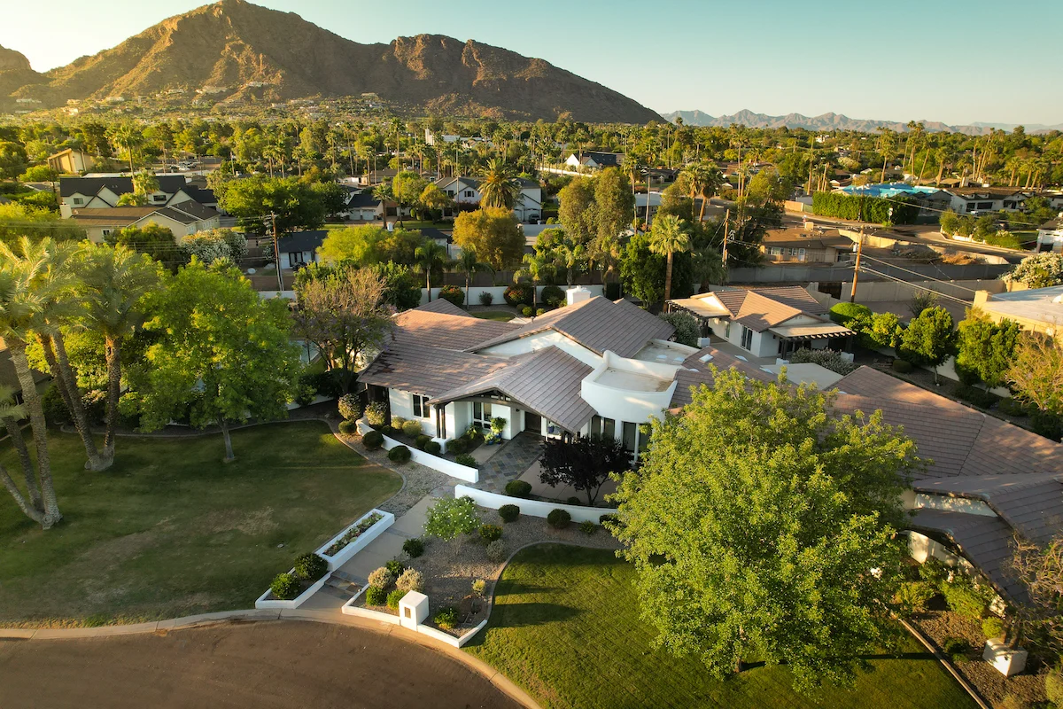
Phoenix, AZ
Phoenix, AZ
Phoenix, AZ
How Drone Data Is Used in Insurance Claims and Property Disputes
In-depth perspectives on drone technology, industry shifts, and the future of aerial work—shared from the pilot’s point of view.
Jan 12, 2025
Why Photos from Your Phone Don’t Cut It Anymore
Insurance adjusters and legal teams want proof — but traditional photos often miss the full story.
Whether it’s storm damage, a boundary disagreement, or roof collapse, ground-level shots can’t:
Capture the entire scope of damage
Show the timeline of degradation
Provide geo-tagged or measurable evidence
That’s where drone data makes the difference.
How Drones Strengthen Your Insurance Claim
Drone inspections provide:
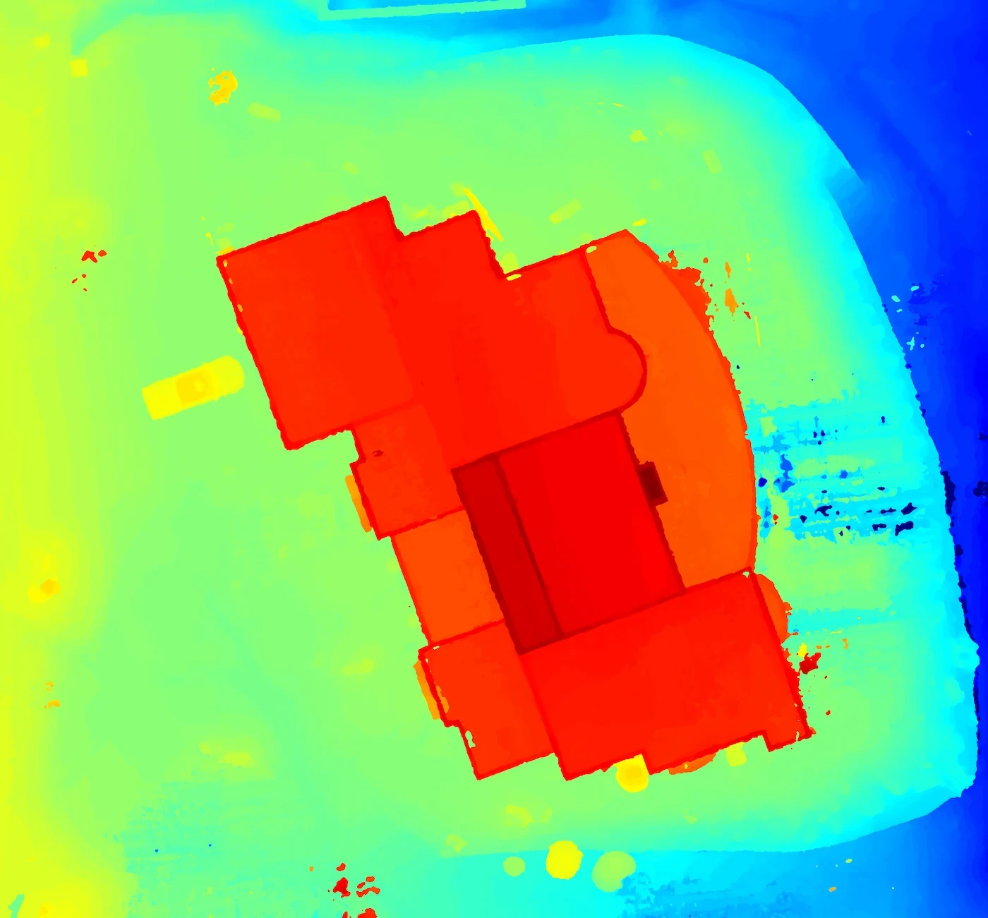
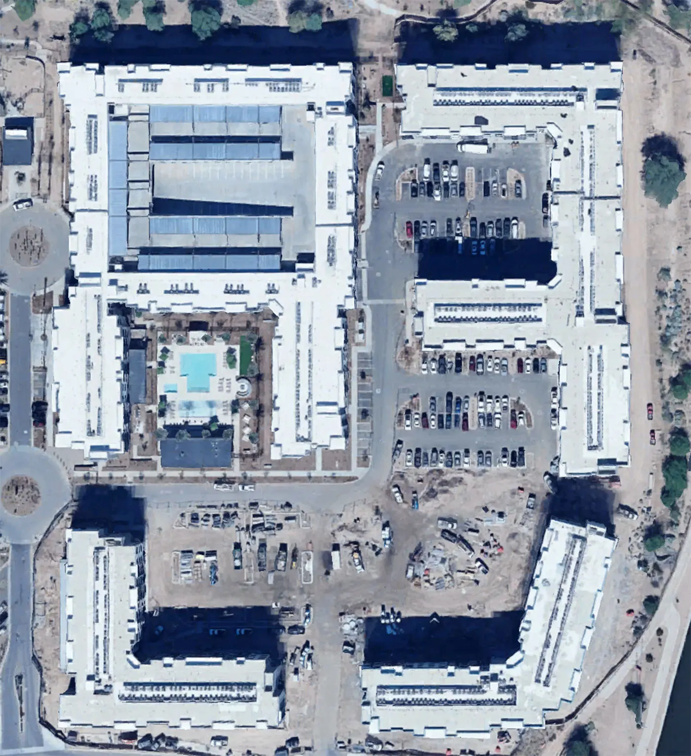
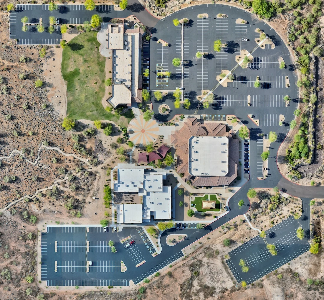
High-resolution imagery of the full roof or property
3D models to show sagging, displacement, or volume loss
Thermal imaging to detect water intrusion, missing insulation, or heat leakage
Timestamps and coordinates for documentation integrity
This kind of evidence can shorten processing times and reduce disputes with insurance carriers — especially during monsoon season or after hailstorms in Arizona.
Property Disputes? Aerial Imagery Offers Visual Clarity
While only licensed surveyors can legally define property boundaries, high-resolution drone imagery can support property-related concerns by:
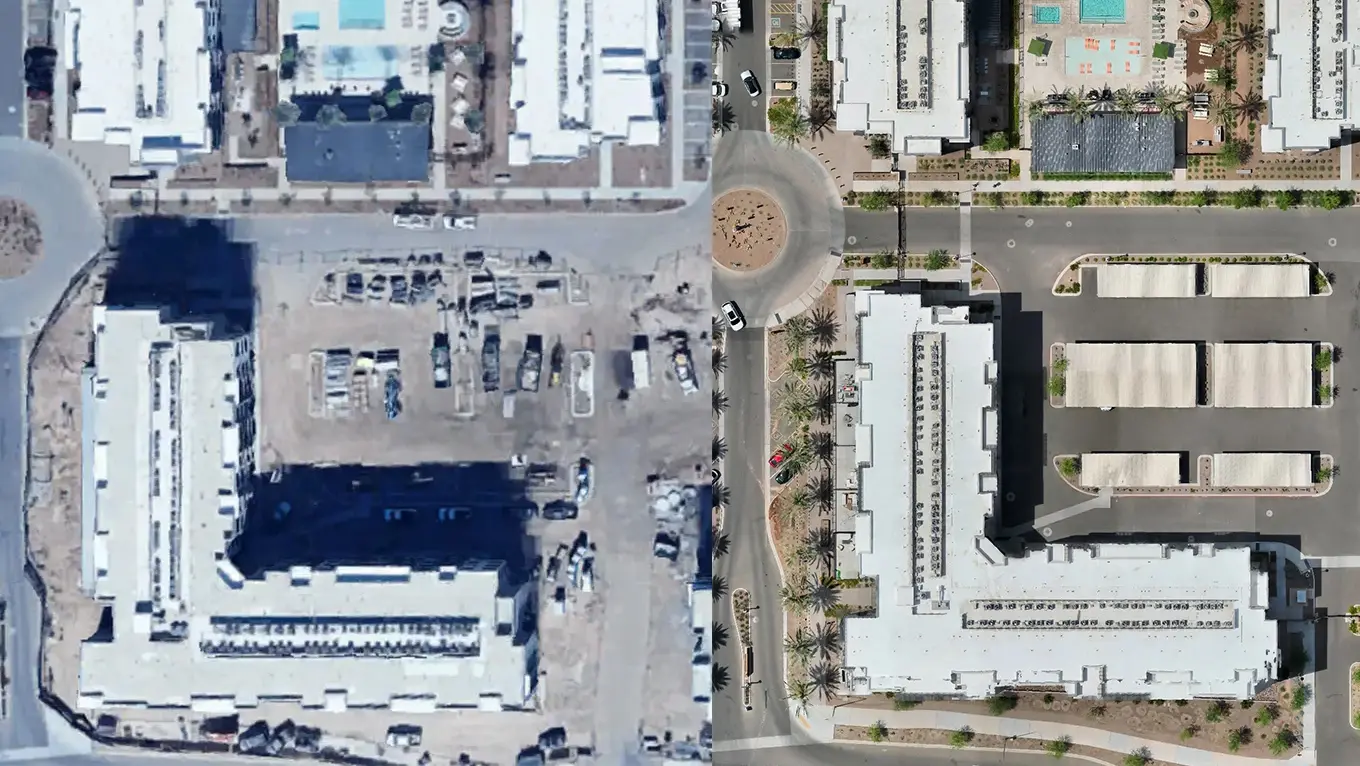
Showing structure placement in context with fences, trees, and landmarks
Providing before-and-after comparisons over time
Documenting visible damage or encroachment for lawyers, adjusters, or contractors
Drone data doesn’t replace a legal survey — but it can visually reinforce your side of the story.
Who Can Use This Data?
Homeowners dealing with roof claims or tree damage
Contractors wanting to verify job completion
Lawyers handling property disputes
HOAs needing aerial documentation of shared spaces
More from the blog
How Drone Data Is Used in Insurance Claims and Property Disputes
In-depth perspectives on drone technology, industry shifts, and the future of aerial work—shared from the pilot’s point of view.
Jan 12, 2025
Why Photos from Your Phone Don’t Cut It Anymore
Insurance adjusters and legal teams want proof — but traditional photos often miss the full story.
Whether it’s storm damage, a boundary disagreement, or roof collapse, ground-level shots can’t:
Capture the entire scope of damage
Show the timeline of degradation
Provide geo-tagged or measurable evidence
That’s where drone data makes the difference.
How Drones Strengthen Your Insurance Claim
Drone inspections provide:
High-resolution imagery of the full roof or property
3D models to show sagging, displacement, or volume loss
Thermal imaging to detect water intrusion, missing insulation, or heat leakage
Timestamps and coordinates for documentation integrity
This kind of evidence can shorten processing times and reduce disputes with insurance carriers — especially during monsoon season or after hailstorms in Arizona.
Property Disputes? Aerial Imagery Offers Visual Clarity
While only licensed surveyors can legally define property boundaries, high-resolution drone imagery can support property-related concerns by:
Showing structure placement in context with fences, trees, and landmarks
Providing before-and-after comparisons over time
Documenting visible damage or encroachment for lawyers, adjusters, or contractors
Drone data doesn’t replace a legal survey — but it can visually reinforce your side of the story.
Who Can Use This Data?
Homeowners dealing with roof claims or tree damage
Contractors wanting to verify job completion
Lawyers handling property disputes
HOAs needing aerial documentation of shared spaces
More from the blog
11 Apr 2025
The Drone Industry Is Taking Off — And It’s Just Getting Started
Read more
11 Apr 2025
The Drone Industry Is Taking Off — And It’s Just Getting Started
Read more
11 Jun 2025
What Does a Drone Inspection Actually Look Like?
Read more
11 Jun 2025
What Does a Drone Inspection Actually Look Like?
Read more
2 May 2025
Why You Should Hire a Professional Drone Operator
Read more
2 May 2025
Why You Should Hire a Professional Drone Operator
Read more
Precision Drone Data. Delivered Fast.
Accurate aerials and insights when you need them.