
Aerial Photo & Video
Capturing Endurance: Aerial Coverage of the Utah 115
Explore real-world drone projects, insights, and the impact aerial data makes on every job.
16 May 2025
Introduction
When the Utah 115 ultramarathon race set off through the rugged red rock and high desert of Kanab, we were tasked with one goal: tell the story from above. With over 100 miles of grueling terrain and remote stretches, traditional videography couldn’t capture the full scale. Our drone coverage brought the race to life.
Following the Action
Using live-trackers, we captured runners from start to finish across varied terrain—switchbacks, ridge lines, canyons, and open desert. Aerial footage gave a cinematic perspective on the race’s intensity and isolation, providing content that felt as epic as the challenge itself.
Logistics and Precision
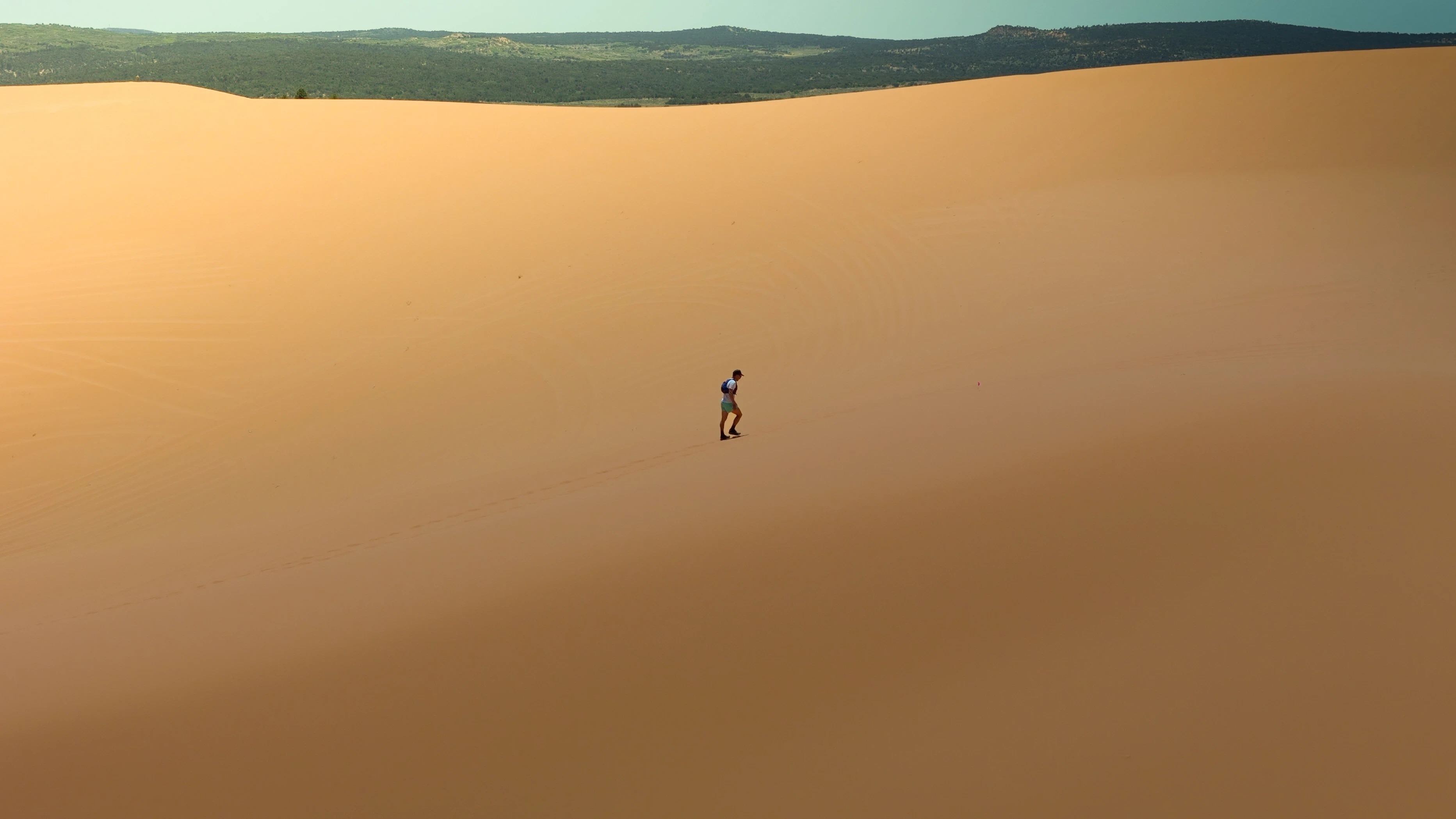
Coordinating drone flights over such a large course required careful planning, battery logistics, and coordination with race officials. We pre-planned shot locations for dramatic effect and used line-of-sight and high-elevation vantage points to maintain visual contact safely. The race extended over Pink Coral Sand Dunes State Park requiring special permits and coordination with park officials to track the runners with cinematic aerial shots.
Storytelling That Moves
The final edit blended sweeping desert vistas, tight tracking shots, and ground-level inserts. It became the race's promotional centerpiece, helping event organizers attract sponsors, showcase their course, and build hype for future years.
Why It Matters
Drone storytelling adds value far beyond simple documentation. For races like the Utah 115, it elevates their brand, supports marketing efforts, and gives participants a visual memory of their achievement. When people see this footage, they don’t just understand the race—they feel it.
Conclusion
The Utah 115 pushed limits, and we were proud to push ours capturing it. Whether it’s endurance sports or outdoor events, we deliver the visuals that do your story justice.

More from the portfolio

Precision Drone Data. Delivered Fast.
Accurate aerials and insights when you need them.