Drone Mapping
Outdated Satellite vs. Real-Time Reality: Entrada in Scottsdale
Explore real-world drone projects, insights, and the impact aerial data makes on every job.
6 Apr 2025
Outdated Satellite, Incomplete Story
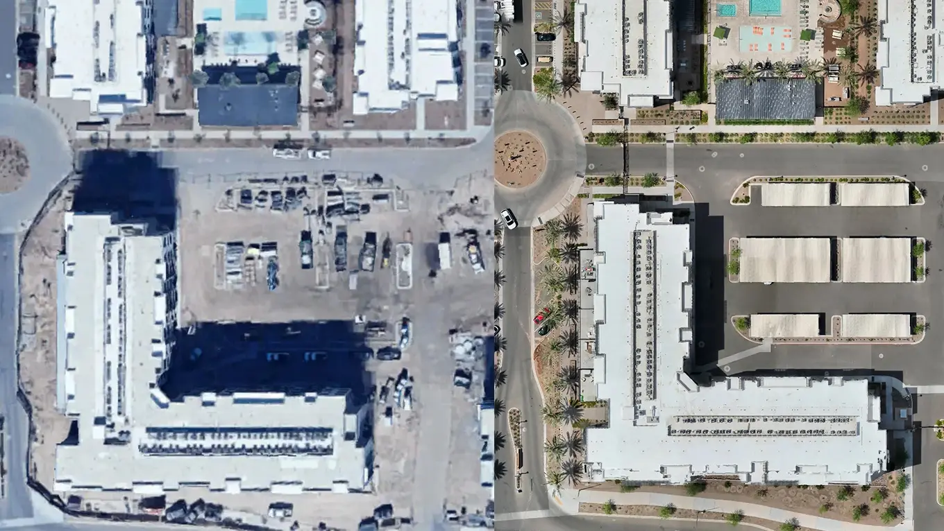
Satellite imagery still shows Entrada Apartments in Scottsdale as a construction site — just dirt and the early outlines of development. But the project is long finished, and that outdated view doesn’t reflect the modern community that now stands there. That’s where I stepped in.
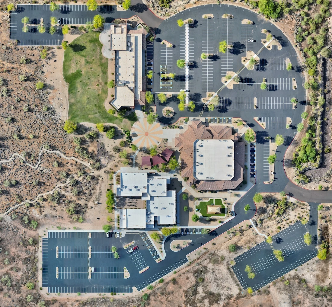
Outdated Satellite Image From Google Earth (See Bottom Half):
Capturing the Full Picture
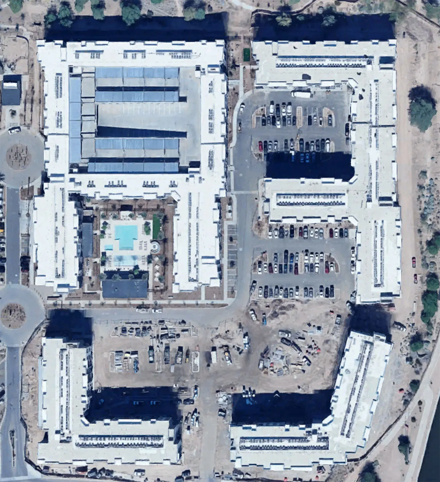
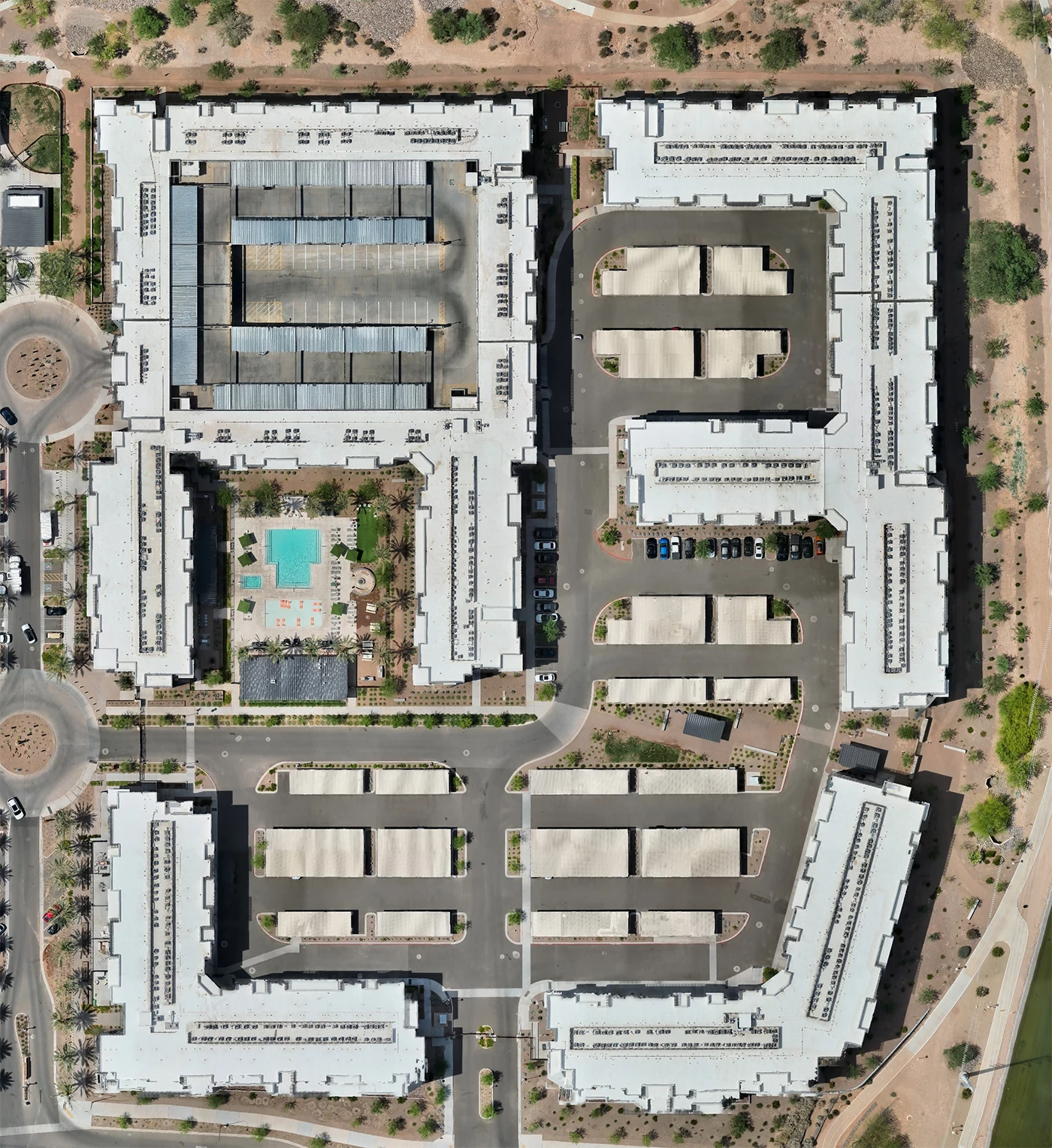
My goal was to produce a high-resolution, up-to-date orthomosaic of the entire Entrada property. This allows developers, property managers, and stakeholders to view the current layout, landscaping, and infrastructure in a way no satellite image can.
More Than a Map
For a site like Entrada, this orthomosaic isn’t just a pretty picture. It’s a real-time visual record that can be used for planning, marketing, investor reports, or property documentation. It’s current, accurate, and completely clear — unlike public satellite imagery that’s years out of date.
Why It Matters
Whether for construction, commercial properties, or development records, this project shows how drone mapping delivers clarity where satellite imagery falls short. If you're working with outdated visuals, drone data is the way forward.
More from the portfolio

Precision Drone Data. Delivered Fast.
Accurate aerials and insights when you need them.