Aerial Photo & Video
Commercial Real Estate Drone Photography in Phoenix: Apartments, Offices & More
Explore real-world drone projects, insights, and the impact aerial data makes on every job.
10 Jun 2025
📸 Commercial Real Estate Drone Photography in Phoenix
From leasing strategy to investor reports, great visuals sell space — fast. Below is a selection of drone photography captured for commercial real estate across the Phoenix metro area. These shots go beyond aesthetics — they help clients stand out in listings, presentations, and development plans.
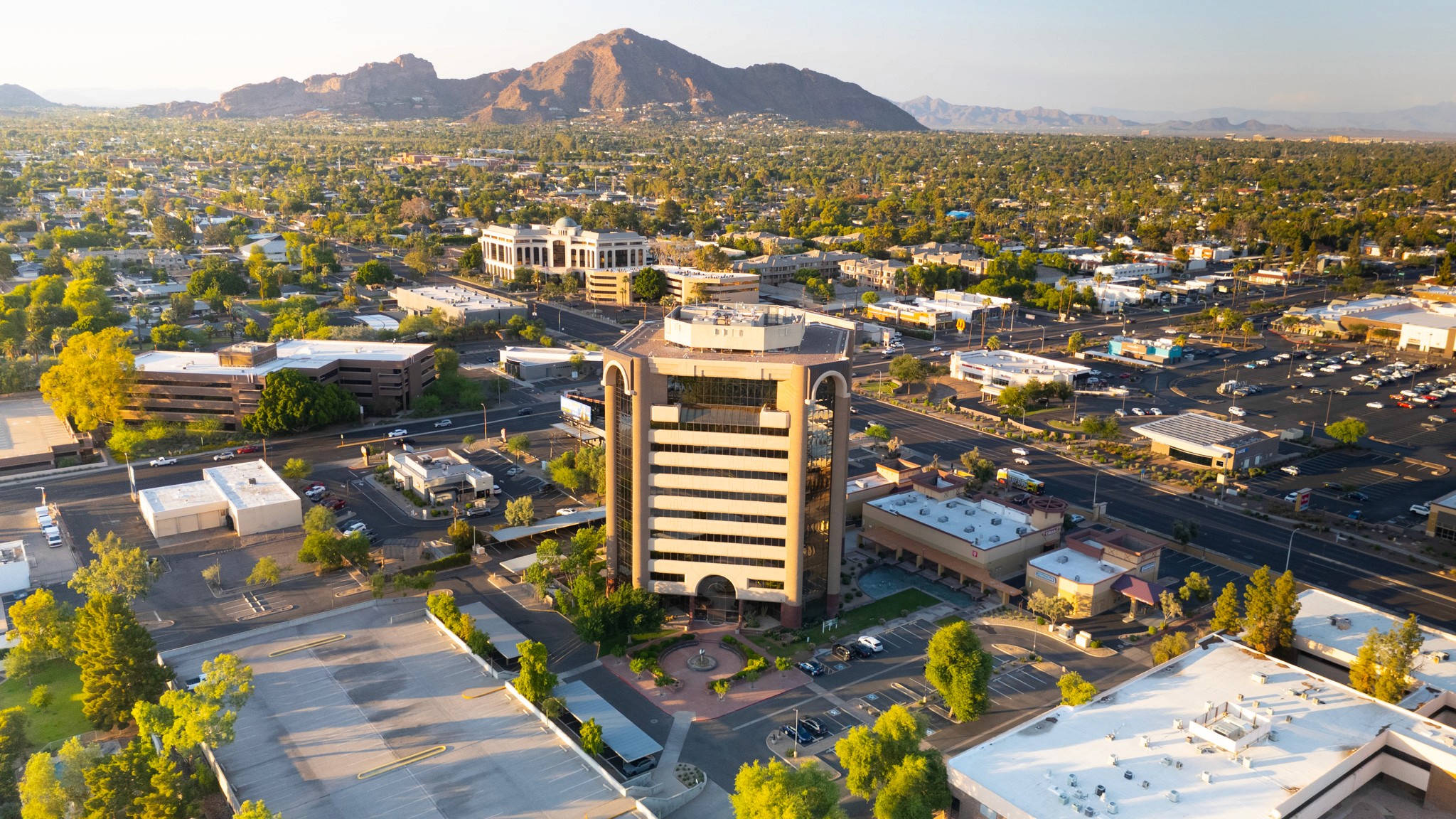
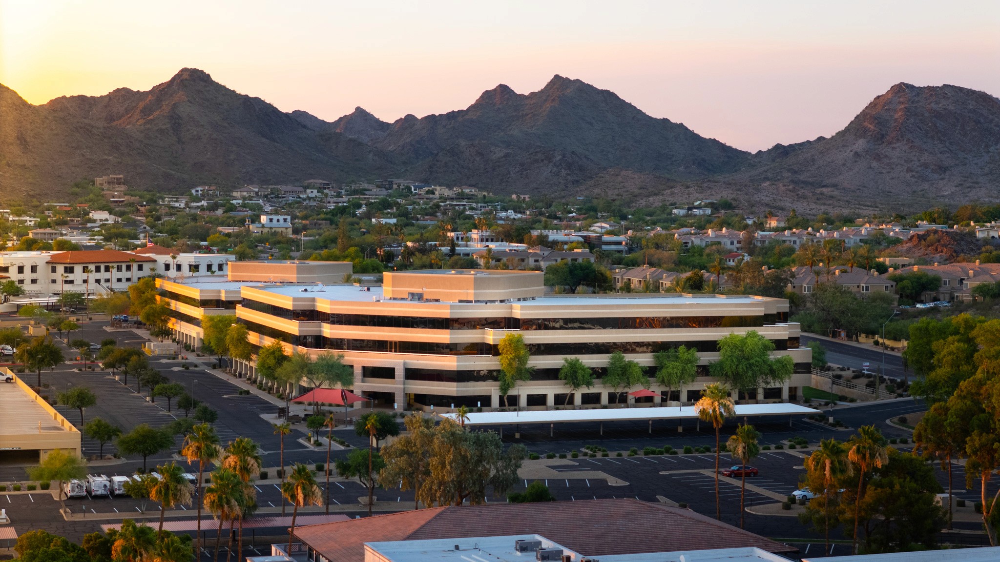
🏢 Class A Office Tower | Camelback Corridor
Drone photography was used to highlight the structure’s height, central location, and stunning backdrop of Camelback Mountain. Capturing this golden-hour elevation helped the leasing team showcase premium visibility and surrounding amenities to prospective tenants.

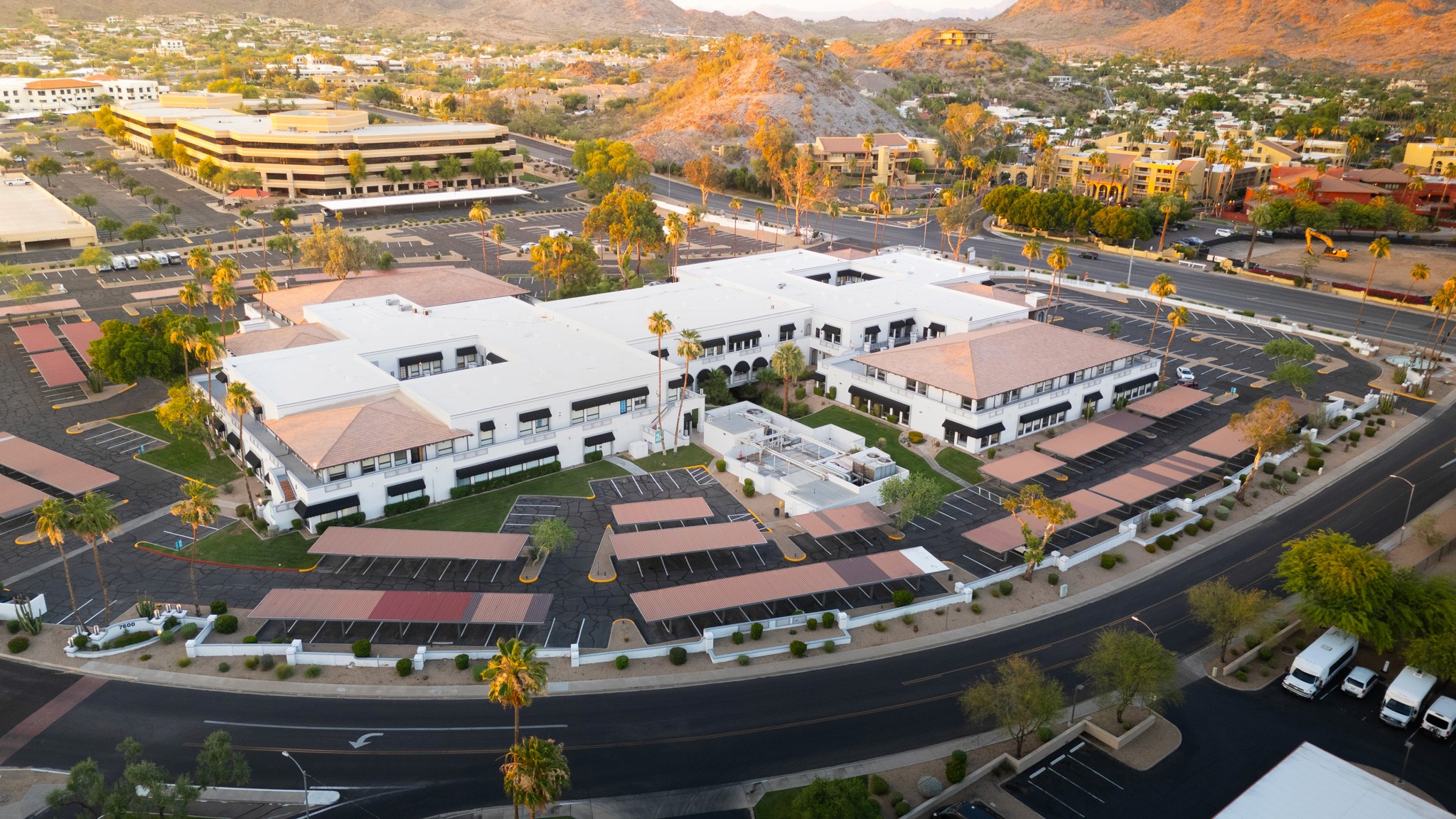
🏬 Medical Office & Mixed Retail | Central Phoenix
This low-rise property combines professional suites with high-traffic visibility. Aerial images gave ownership a clean, comprehensive view for both internal planning and future marketing decks — a huge value-add over older satellite views.

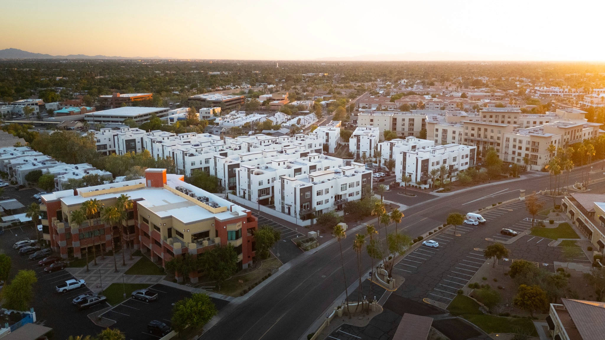
🏘️ Mid-Rise Apartments | Central Phoenix Area
Captured during sunset to maximize visual appeal, these shots brought warmth and life to the community’s marketing materials. The drone perspective also made it easier to show proximity to nearby amenities, which is hard to achieve with ground-level photos.
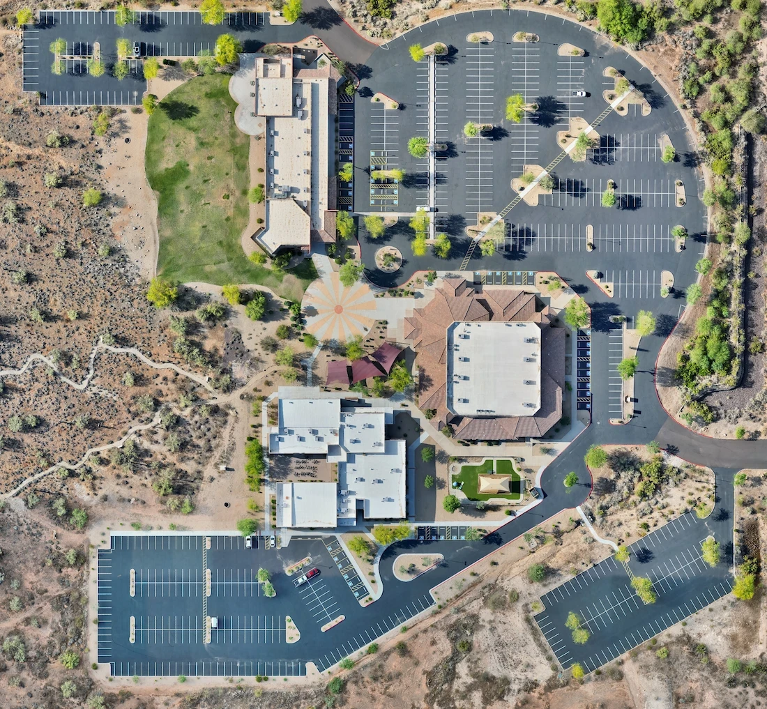
🏢 Corporate Office Complex | Paradise Valley Foothills
Sunset drone photography was used to emphasize the modern design and scenic mountain views that surround this multi-building property. The aerial perspective showcased parking layout, entryways, and walkability — key selling points for businesses seeking a new HQ.
🏢 Business Park Aerials | Morning Golden Hour
By capturing the full layout and mountain backdrop in soft morning light, this drone shoot helped tell the full story of this high-traffic location. The clear visuals of parking, landscaping, and access roads added tangible value to both brokers and property managers.
📈 Ready to Elevate Your Property?
Drone imagery isn’t just about pretty photos — it’s about helping your space perform better in the market. Whether you're listing, planning, or reporting to investors, clean aerial visuals save time and tell the full story of your property.
👉 Request a free quote and let's talk about your next project.
More from the portfolio

Precision Drone Data. Delivered Fast.
Accurate aerials and insights when you need them.