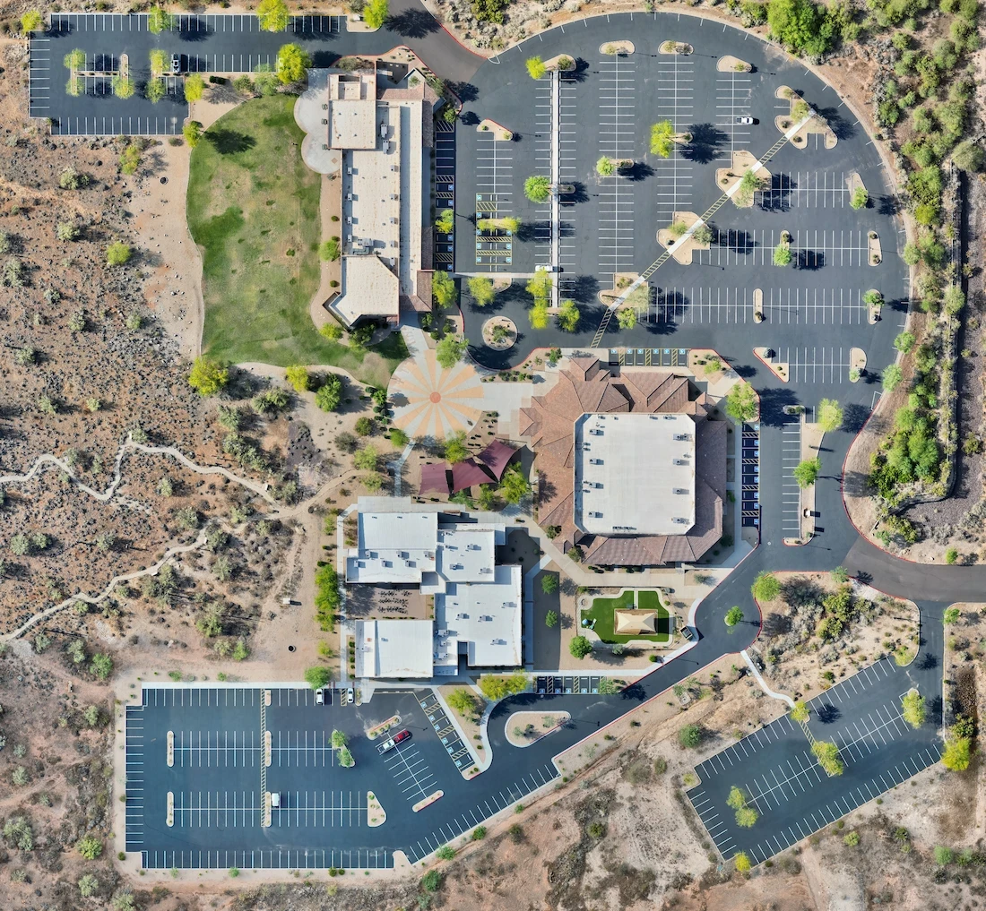
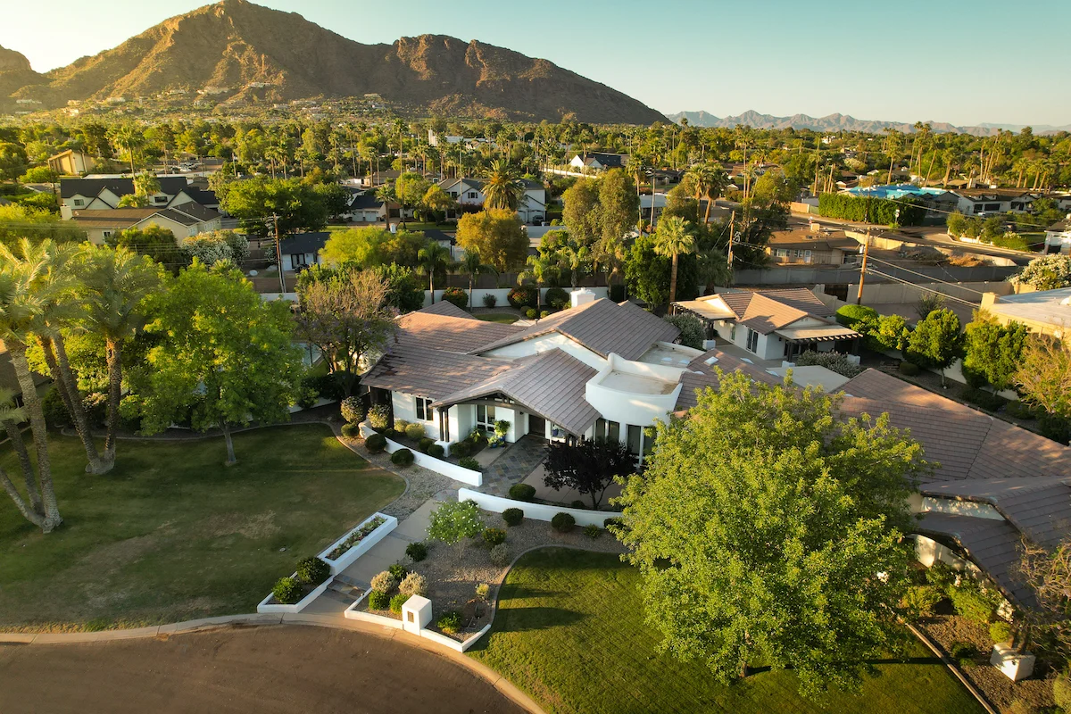
Phoenix, AZ
Phoenix, AZ
Phoenix, AZ
Aerial Data Accuracy: Why RTK and Laser Rangefinding Matter in Drone Mapping
In-depth perspectives on drone technology, industry shifts, and the future of aerial work—shared from the pilot’s point of view.
Feb 1, 2025
Why Regular Drone GPS Isn’t Enough
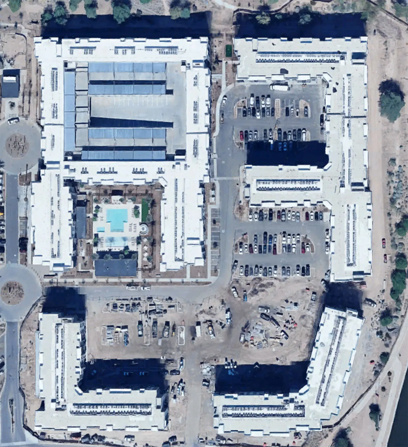
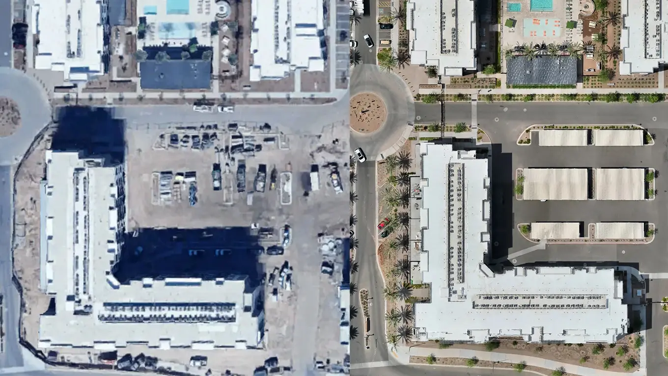
Most consumer drones rely on standard GPS, which is only accurate within 1–3 meters — not bad for casual flying, but nowhere near precise enough for serious mapping or inspections.
That level of drift can throw off:
Roof measurements
Volume calculations
Site planning accuracy
Alignment with CAD or satellite overlays
That’s where RTK and laser rangefinding step in.
What Is RTK and Why It Matters
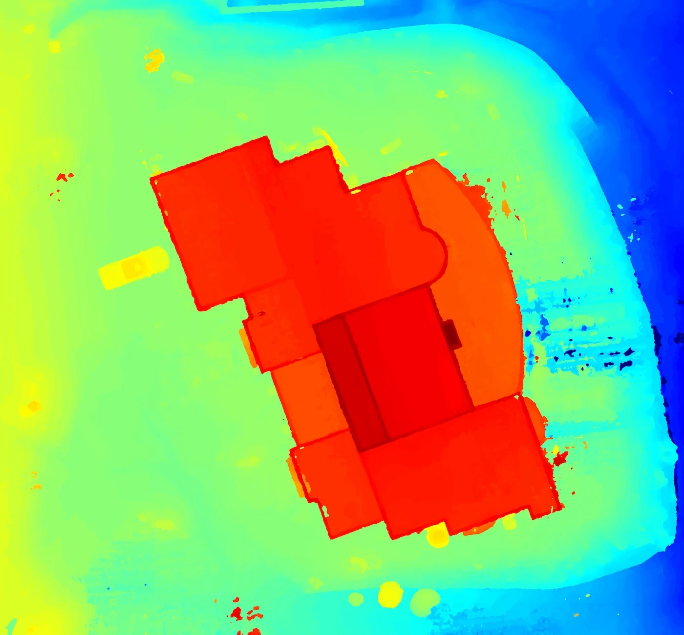
RTK (Real-Time Kinematic) positioning dramatically increases drone accuracy — often to within 1–5 centimeters.
It works by:
Correcting GPS signals in real-time using nearby ground stations or cellular correction networks
Eliminating satellite drift errors
Syncing image positions with extremely tight tolerances
This is critical for:
Construction site mapping
Accurate 3D models
Pre-design planning
Commercial roof measurements
📍 In Phoenix, RTK correction networks are widely available — making it easy to fly with extreme accuracy without a bulky base station.
What a Laser Rangefinder Adds
Laser rangefinders provide a direct distance-to-subject reading from the drone — useful for:
Measuring distance to a roof, tower, or ground
Confirming subject height or structure elevation
Placing markers during inspections or mapping
On drones like the DJI Matrice 4T, rangefinder data is visible during flight and can be recorded with screen capture or logs.
Why This Matters for Clients
Clients in construction, roofing, telecom, and solar need more than pretty pictures — they need:
Measurable results
Confident planning data
Repeatable accuracy
RTK and laser-equipped drones bring that to the table — and avoid costly measurement mistakes or revisits.
Need precise data that’s ready for reporting, CAD, or quoting?
Request a free quote from Arcoast — we deliver laser-calibrated drone mapping with accuracy.
More from the blog
Aerial Data Accuracy: Why RTK and Laser Rangefinding Matter in Drone Mapping
In-depth perspectives on drone technology, industry shifts, and the future of aerial work—shared from the pilot’s point of view.
Feb 1, 2025
Why Regular Drone GPS Isn’t Enough
Most consumer drones rely on standard GPS, which is only accurate within 1–3 meters — not bad for casual flying, but nowhere near precise enough for serious mapping or inspections.
That level of drift can throw off:
Roof measurements
Volume calculations
Site planning accuracy
Alignment with CAD or satellite overlays
That’s where RTK and laser rangefinding step in.
What Is RTK and Why It Matters
RTK (Real-Time Kinematic) positioning dramatically increases drone accuracy — often to within 1–5 centimeters.
It works by:
Correcting GPS signals in real-time using nearby ground stations or cellular correction networks
Eliminating satellite drift errors
Syncing image positions with extremely tight tolerances
This is critical for:
Construction site mapping
Accurate 3D models
Pre-design planning
Commercial roof measurements
📍 In Phoenix, RTK correction networks are widely available — making it easy to fly with extreme accuracy without a bulky base station.
What a Laser Rangefinder Adds
Laser rangefinders provide a direct distance-to-subject reading from the drone — useful for:
Measuring distance to a roof, tower, or ground
Confirming subject height or structure elevation
Placing markers during inspections or mapping
On drones like the DJI Matrice 4T, rangefinder data is visible during flight and can be recorded with screen capture or logs.
Why This Matters for Clients
Clients in construction, roofing, telecom, and solar need more than pretty pictures — they need:
Measurable results
Confident planning data
Repeatable accuracy
RTK and laser-equipped drones bring that to the table — and avoid costly measurement mistakes or revisits.
Need precise data that’s ready for reporting, CAD, or quoting?
Request a free quote from Arcoast — we deliver laser-calibrated drone mapping with accuracy.
More from the blog
11 Apr 2025
The Drone Industry Is Taking Off — And It’s Just Getting Started
Read more
11 Apr 2025
The Drone Industry Is Taking Off — And It’s Just Getting Started
Read more
11 Jun 2025
What Does a Drone Inspection Actually Look Like?
Read more
11 Jun 2025
What Does a Drone Inspection Actually Look Like?
Read more
2 May 2025
Why You Should Hire a Professional Drone Operator
Read more
2 May 2025
Why You Should Hire a Professional Drone Operator
Read more
Precision Drone Data. Delivered Fast.
Accurate aerials and insights when you need them.